科研团队
Chenglu Wen 温程璐
Professor 教授,博士生导师,国家高层次青年人才
clwen@xmu.edu.cn

人工智能系教授,福建省智慧城市感知与计算重点实验室副主任。主要从事三维视觉、点云智能处理、具身智能主动感知方面研究。主持国家自然科学基金项目三项等国家级项目。成果发表在CVPR、ICCV、ECCV、NeurIPS等人工智能国际会议,和IEEE TPAMI、IEEE TGRS、IEEE TITS、ISPRS JPRS等期刊上。获国际摄影测量与遥感学会ISPRS Otto von Gruber奖(www.isprs.org/society/awards/gruber.aspx, 2022),福建省高等教育教学成果奖特等奖(2022),福建省科技进步奖二等奖(2021,2022),中国激光雷达青年科技奖(2020),福建省自然科学优秀学术论文奖二等奖(2022),CCF智能汽车青年激励计划(2024)。担任IEEE Transactions on Intelligent Transportation Systems期刊Senior Editor,IEEE Geoscience and Remote Sensing Letters期刊Associate Editor,ISPRS I/2移动测图技术工作组联合主席,CSIG 厦门会员活动中心执委会主席。为CCF智能汽车分会执行委员,CSIG三维视觉专委会委员,CNISDE激光雷达专委会委员等。


主持的科研项目

  • 国家自然科学基金项目,面向城市动态场景三维感知的点云序列弱监督学习,2022-2025

  • 国家自然科学基金项目,联合可测点云/多视角图像的大规模对象标记数据集生成,2018-2021

  • 国家自然科学基金项目,室内移动三维测图点云数据的多元质量评价与修补,2015-2017

  • 国家重点研发计划青年科学家项目,多平台多模态点云大数据智能处理关键技术与软件(任务),2022-2024


Dr. Chenglu Wen is a Professor at the Department of Artificial Intelligence at Xiamen University. She was the deputy head of the Department of Artificial Intelligence. She is mainly engaged in the research of 3D scene perception and understanding, LiDAR point cloud processing, and 3D vision. She has been granted 3 National Natural Science Foundation of China projects. She has published over 100 papers and authorized over ten invention patents. She received the 2022 ISPRS Otto von Gruber Award (www.isprs.org/society/awards/gruber.aspx), the 2020 China LiDAR Youth Science and Technology Award, and Best Paper of the 2017 International Mobile Mapping Technology Conference. She serves as the Senior Editor of IEEE Transactions on Intelligent Transportation Systems, and Associate Editor of IEEE Geoscience and Remote Sensing Letters. She is also the co-chair of ISPRS working group I/2 Mobile Mapping Technology (2022-2026). 


News

  • 09/2024, two papers are accepted to NeurIPS 2024

  • 09/2024, our HiSC4D paper is accepted to IEEE TPAMI

  • 07/2024, one paper is accepted to ECCV 2024

  • 02/2024, five papers are accepted to CVPR 2024

  • 12/2023, two papers are accepted to AAAI 2024

  • 07/2023, one paper is accepted to ICCV 2023

  • 02/2023, four papers are accepted to CVPR 2023

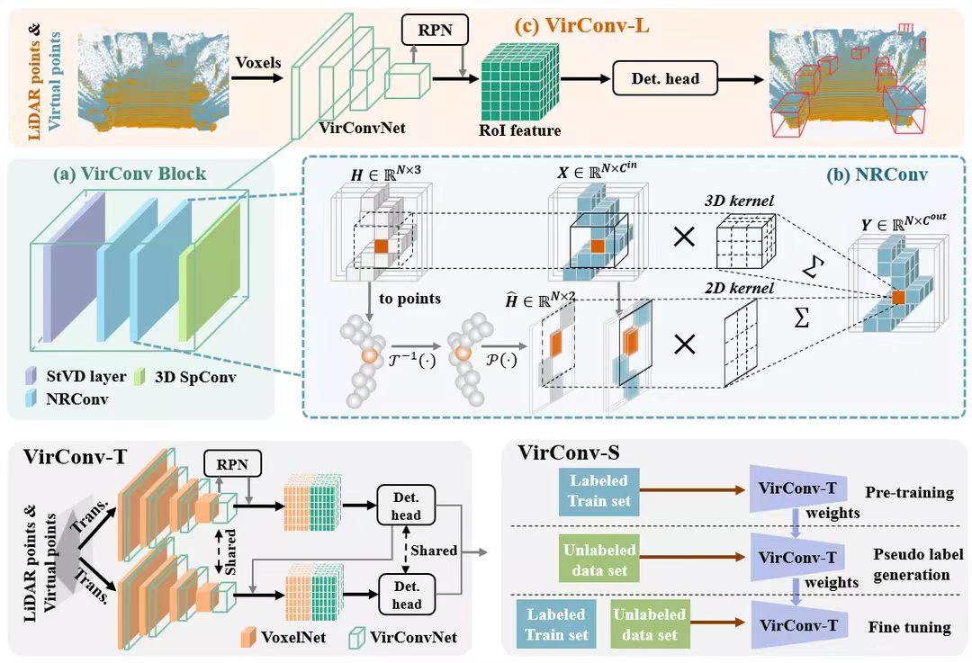
  • 11/2022, our VirConv-S method ranks No.1(car) on the KITTI 2D, 3D and BEV detection leaderboard

  • 11/2022, our VirConvTrack ranks No.1(car) on the KITTI tracking leaderboard

  • 11/2022, our 3D object detection paper TED is accepted to AAAI 2023

  • 09/2022, our CasTrack ranks No.1(car) on the KITTI tracking leaderboard

  • 06/2022, receive ISPRS Otto von Gruber Award

  • 05/2022, our TED method ranks No.1(car) on the KITTI 3D detection leaderboard (until 11/2022)

  • 05/2022, our CasA++ method ranks No.1(ped. and cyc.)/No.2(car)  on the KITTI 3D detection leaderboard

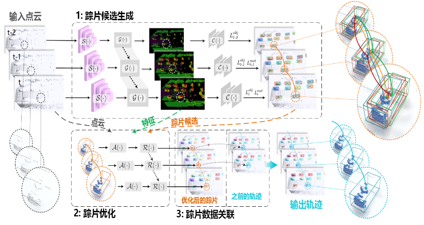
  • 03/2022, two Lidar motion capture papers are accepted to CVPR 2022

  • 04/2021, two papers are accepted to IJCAI 2021

  • 01/2021, our PC-TCNN ranks No.1(car) on the KITTI tracking leaderboard

  • 11/2020, I receive CNISDE Lidar Youth Science and Technology Award

  • 06/2020, our paper “road scene labeling” reached ESI highly cited paper

  • 11/2019, our paper “Point2Node” is accepted to AAAI 2020 as Oral Presentation

  • 02/2019, two papers are accepted to CVPR 2019


研究方向 Research
发表的数据集 Datasets 部分论文列表 Selected Publications
2024
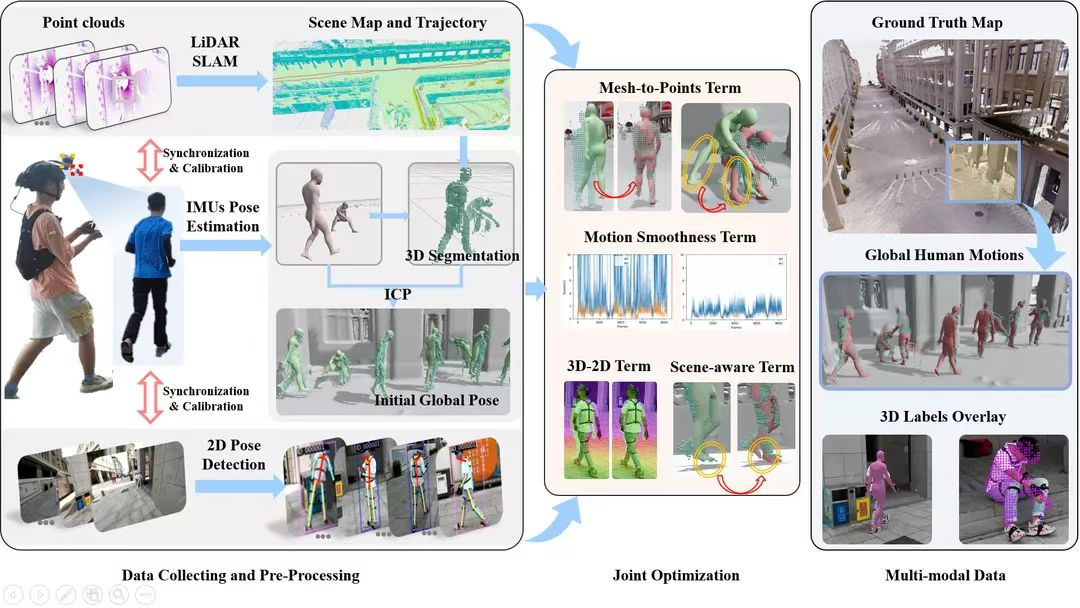
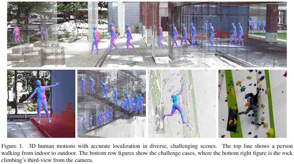
Yudi Dai, Zhiyong Wang, Xiping Lin, Chenglu Wen*, Lan Xu, Siqi Shen, Yuexin Ma, Cheng Wang
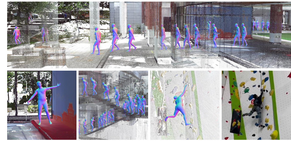
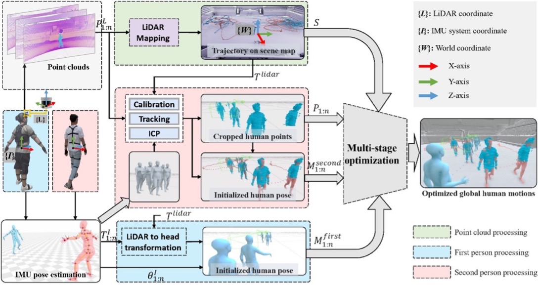
HiSC4D: Human-centered interaction and 4D Scene Capture in Large-scale Space Using Wearable IMUs and LiDAR
IEEE Transactions on Pattern Analysis and Machine Intelligence
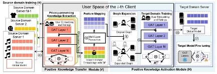
Ziqi Yang, Chaopeng Peng, Ziwei Wang, Jianzhong Qi, Chaochao Chen, Weike Pan, Chenglu Wen, Cheng Wang, Xiaoliang Fan*
Federated Graph Learning for Cross-Domain Recommendation
NeurIPS 2024
Kezheng Xiong, Haoen Xiang, Qingshan Xu, Chenglu Wen*, Siqi Shen, Jonathan Li, Cheng Wang
Mining and Transferring Feature-Geometry Coherence for Unsupervised Point Cloud Registration
NeurIPS 2024
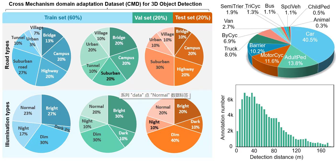
Jinhao Deng, Wei Ye, Hai Wu, Xun Huang, Qiming Xia, Jin Fang, Wei Li*, Chenglu Wen*, Xin Li, Cheng Wang
CMD: A Cross Mechanism Domain Adaptation Dataset for 3D Object Detection
ECCV 2024
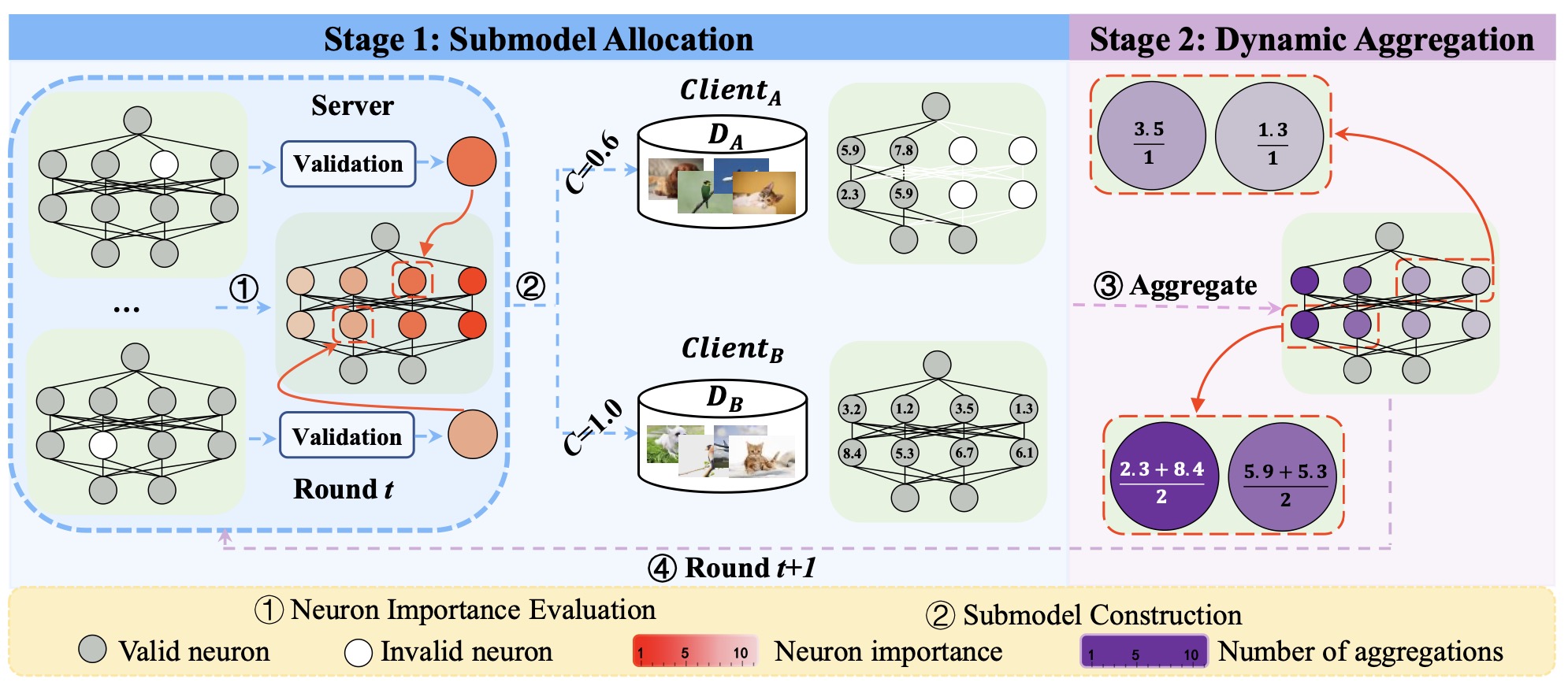
Zihui Wang, Cheng Wang, Xiaoliang Fan, Chenglu Wen et al.
FedSAC: Dynamic Submodel Allocation for Collaborative Fairness in Federated Learning
KDD 2024
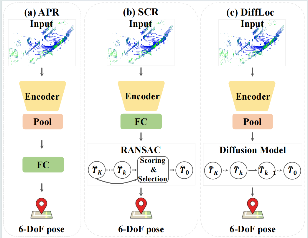
Wen Li, Yuyang Yang, Shangshu Yu, Guosheng Hu, Chenglu Wen, Ming Cheng, Cheng Wang*
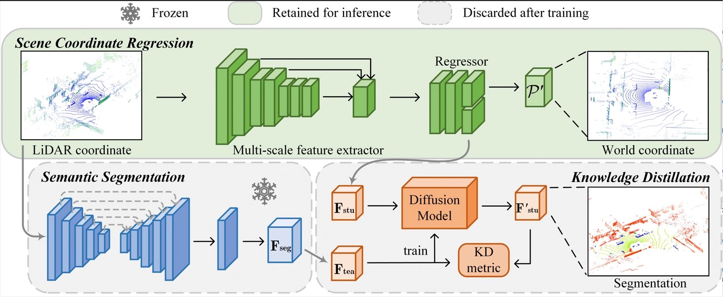
DiffLoc: Diffusion Model for Outdoor LiDAR Localization
CVPR 2024
Hai Wu, Shijia Zhao, Xun Huang, Chenglu Wen*, Xin Li, Cheng Wang
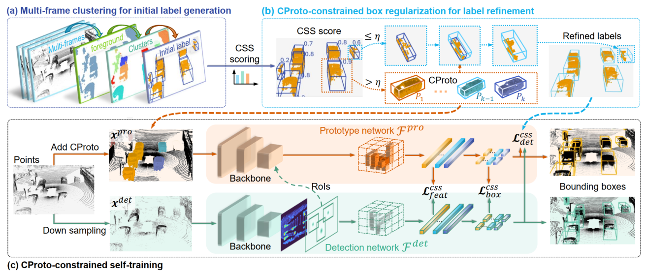
Commonsense Prototype for Outdoor Unsupervised 3D Object Detection
CVPR 2024
Qiming Xia, Wei Ye, Hai Wu, Shijia Zhao, Leyuan Xing, Xun Huang, Jinhao Deng, Xin Li, Chenglu Wen*, Cheng Wang
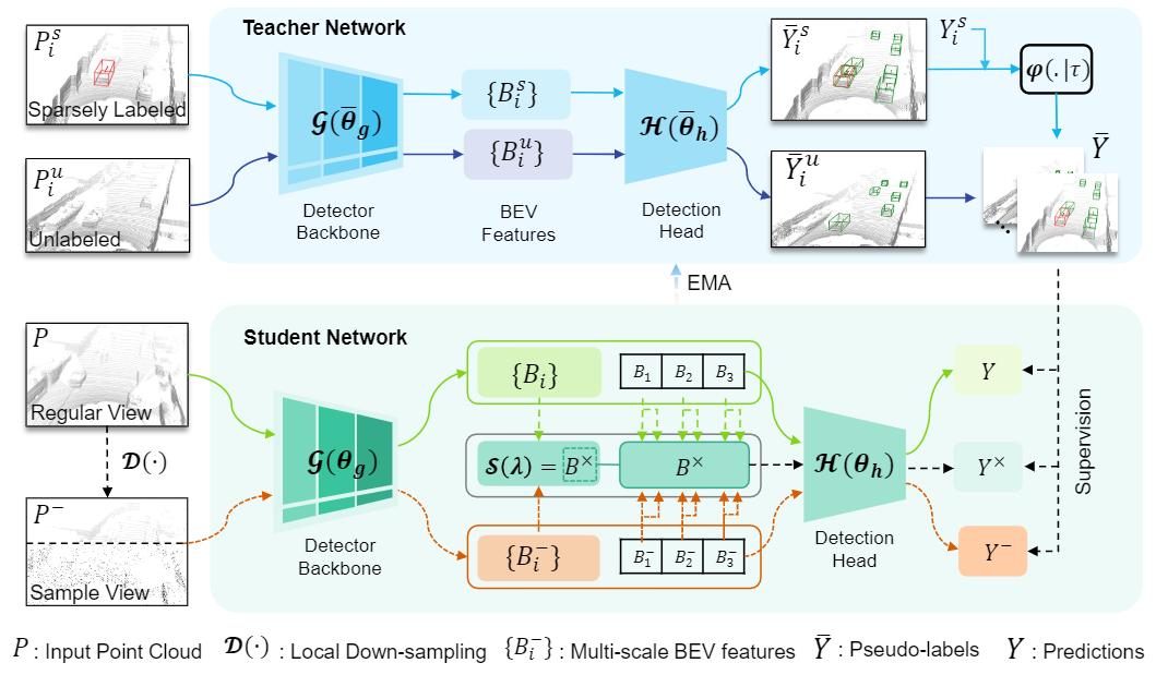
HINTED: Hard Instance Enhanced Detector with Mixed-Density Feature Fusionfor Sparsely-Supervised 3D Object Detection
CVPR 2024
Bochun Yang, Zijun Li, Zhipeng Cai, Wen Li, Chenglu Wen, Yu Zang, Matthias Müller, Cheng Wang*
LiSA:LiDAR Localization with Semantic Awareness
CVPR 2024
Ming Yan, Yan Zhang, Shuqiang Cai, Shuqi Fan, Xincheng Lin, Yudi Dai, Siqi Shen*, Chenglu Wen, Lan Xu, Yuexin Ma, Cheng Wang
RELI11D: A Comprehensive Multimodal Human Motion Dataset and Method
CVPR 2024
Weijie Huang, Pufan Zou, Yan Xia, Chenglu Wen*, Yu Zang, Cheng Wang
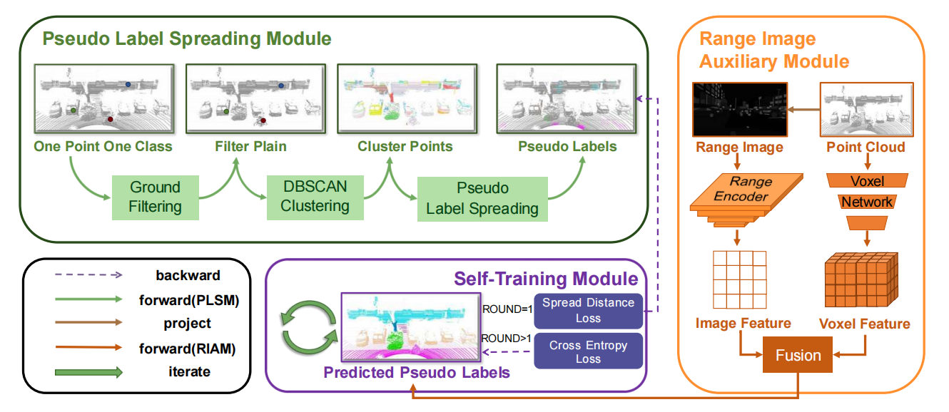
OPOCA:One Point One Class Annotation for LiDAR Point Cloud Semantic Segmentation
IEEE Transactions on Geoscience and Remote Sensing
@article{huang2024opoca, title={OPOCA: One Point One Class Annotation for LiDAR Point Cloud Semantic Segmentation}, author={Huang, Weijie and Zou, Pufan and Xia, Yan and Wen, Chenglu and Zang, Yu and Wang, Cheng and Zhou, Guoqing}, journal={IEEE Transactions on Geoscience and Remote Sensing}, year={2024}, publisher={IEEE} }
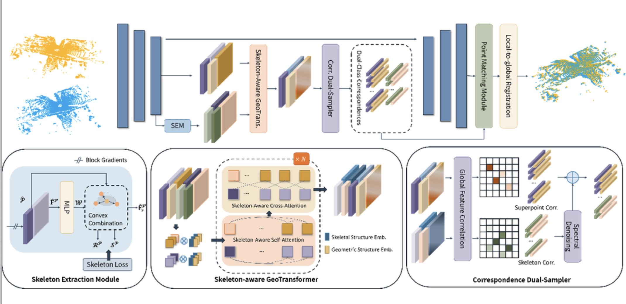
Kezheng Xiong, Maoji Zheng, Chenglu Wen*, Qingshan Xu, Siqi Shen*, Cheng Wang
SPEAL: Skeletal-Prior Embedded Attention Learning for Cross-Source Point Cloud Registration
AAAI 2024
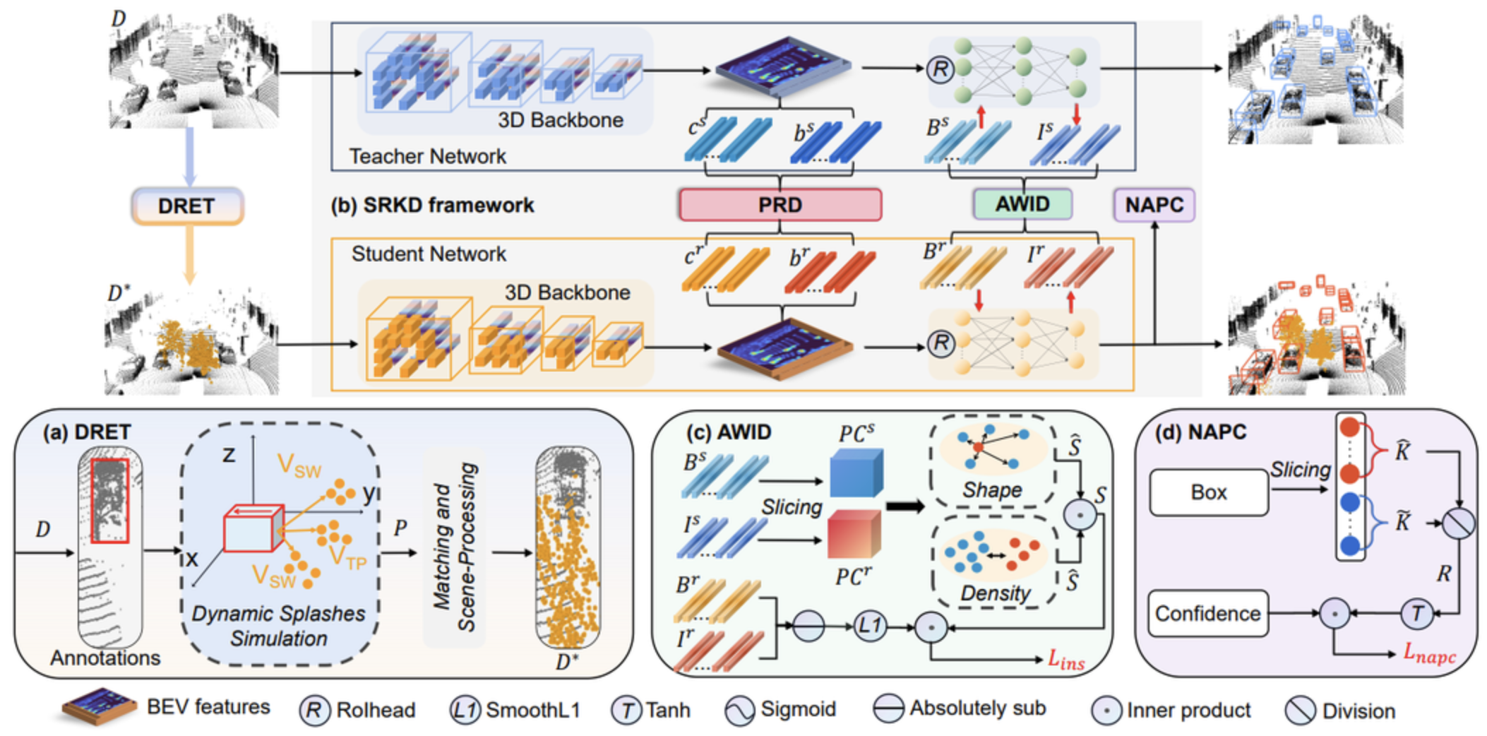
Xun Huang, Hai Wu, Chenglu Wen*, Xiaoliang Fan, Xin Li, Cheng Wang
Sunshine to Rainstorm: Cross-Weather Knowledge Distillation for Robust 3D Object Detection
AAAI 2024
2023
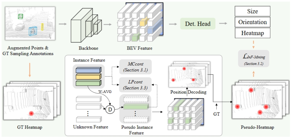
Qiming Xia, Jinhao Deng, Chenglu Wen*, Shaoshuai Shi, Xin Li, Cheng Wang
CoIn: Contrastive Instance Feature Mining for 3D Object Detection with Very Limited Annotations
ICCV 2023
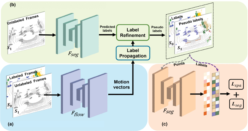
Junhao Zhao, Weijie Huang, Hai Wu, Chenglu Wen*, Bo Yang, Yulan Guo, Cheng Wang
SemanticFlow: Semantic Segmentation of Sequential LiDAR Point Clouds from Sparse Frame Annotations
IEEE Transactions on Geoscience and Remote Sensing, DOI: 10.1109/TGRS.2023.3264102
@ARTICLE{10091688, author={Zhao, Junhao and Huang, Weijie and Wu, Hai and Wen, Chenglu and Yang, Bo and Guo, Yulan and Wang, Cheng}, journal={IEEE Transactions on Geoscience and Remote Sensing}, title={SemanticFlow: Semantic Segmentation of Sequential LiDAR Point Clouds From Sparse Frame Annotations}, year={2023}, volume={61}, number={}, pages={1-11}, doi={10.1109/TGRS.2023.3264102}}
Hai Wu, Chenglu Wen*, Shaoshuai Shi, Xin Li, Cheng Wang
Virtual Sparse Convolution for Multimodal 3D Object Detection
CVPR 2023
@inproceedings{VirConv, title={Virtual Sparse Convolution for Multimodal 3D Object Detection}, author={Wu, Hai and Wen,Chenglu and Shi, Shaoshuai and Wang, Cheng}, booktitle={CVPR}, year={2023} }
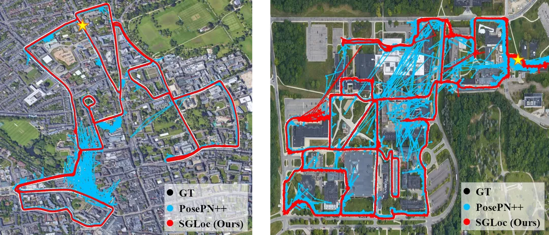
Wen Li, Shangshu Yu, Cheng Wang, Guosheng Hu, Siqi Shen, Chenglu Wen
SGLoc: Scene Geometry Encoding for Outdoor LiDAR Localization
CVPR 2023
暂无
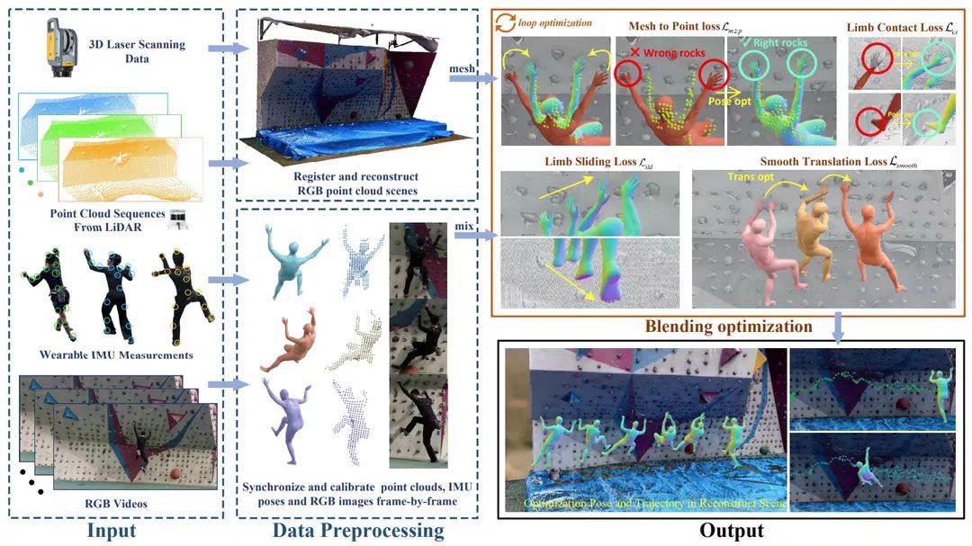
Ming Yan, Xin Wang, Yudi Dai, Siqi Shen*, Chenglu Wen, Lan Xu, Yuexin Ma, Cheng Wang
CIMI4D: A Large Multimodal Climbing Motion Dataset under Human-scene Interactions
CVPR 2023
@inproceedings{yan2023cimi4d,     title     = {CIMI4D: A Large Multimodal Climbing Motion Dataset under Human-scene Interactions},     author    = {Yan, Ming and Wang, Xin and Dai, Yudi and Shen, Siqi and Wen, Chenglu and Xu, Lan and Ma, Yuexin and Wang, Cheng},     booktitle = {IEEE Conference on Computer Vision and Pattern Recognition (CVPR)},     month     = {June},     year      = {2023} }
Yudi Dai, YiTai Lin, XiPing Lin, Chenglu Wen*, Lan Xu, Hongwei Yi, Siqi Shen, Yuexin Ma, Cheng Wang
SLOPER4D: A Scene-Aware Dataset For Global 4D Human Pose Estimation In Urban Environments
CVPR 2023
@inproceedings{dai2023sloper4d, title = {SLOPER4D: A Scene-Aware Dataset for Global 4D Human Pose Estimation in Urban Environments}, author = {Dai, Yudi and Lin, YiTai and Lin, XiPing and Wen, Chenglu and Xu, Lan and Yi, Hongwei and Shen, Siqi and Ma, Yuexin and Wang, Cheng}, booktitle = {IEEE Conference on Computer Vision and Pattern Recognition (CVPR)}, month = {June}, year = {2023} }
Qing Li, Cheng Wang, Chenglu Wen*, Xin Li
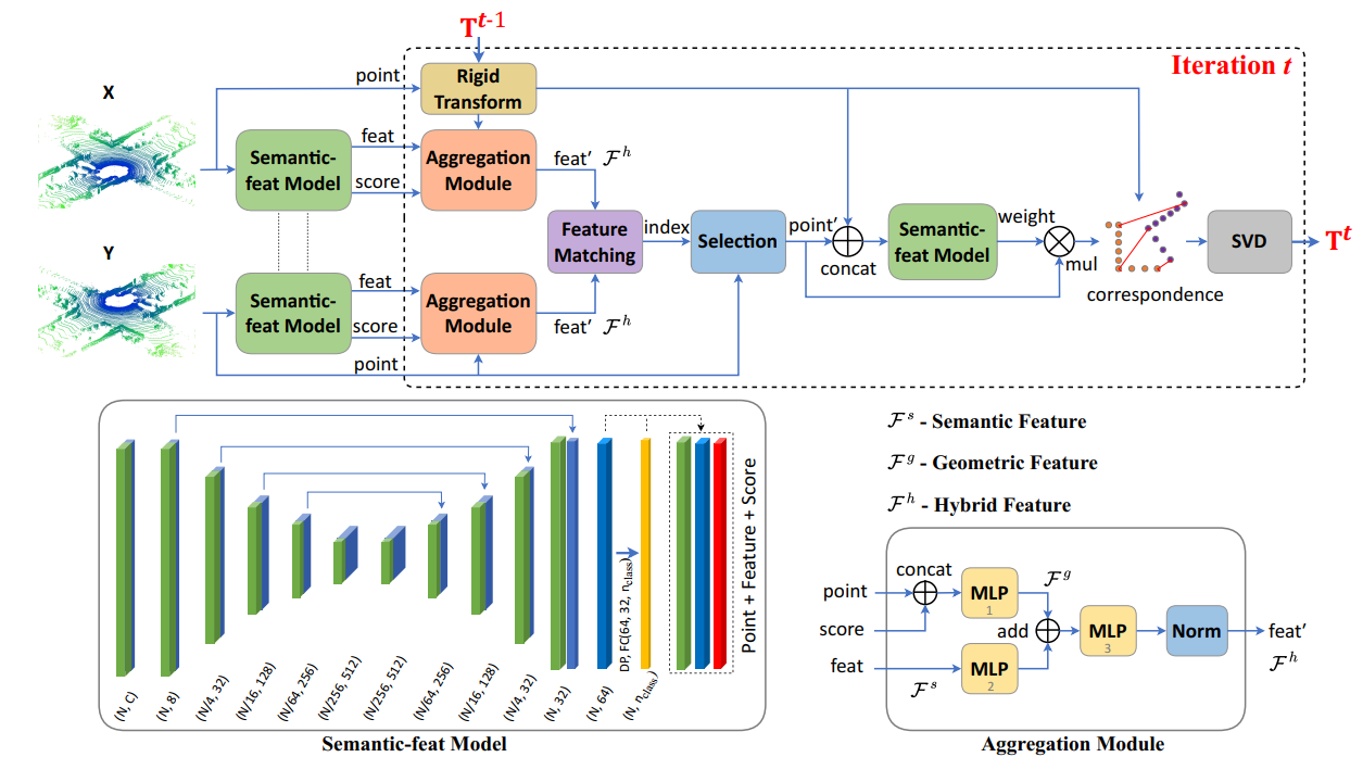
DeepSIR: Deep Semantic Iterative Registration for LiDAR Point Clouds
Pattern Recognition, DOI:10.1016/j.patcog.2023.109306
@article{LI2023109306, title = {DeepSIR: Deep semantic iterative registration for LiDAR point clouds}, journal = {Pattern Recognition}, volume = {137}, pages = {109306}, year = {2023}, issn = {0031-3203}, doi = {https://doi.org/10.1016/j.patcog.2023.109306}, url = {https://www.sciencedirect.com/science/article/pii/S0031320323000079}, author = {Qing Li and Cheng Wang and Chenglu Wen and Xin Li}, }
Hai Wu, Chenglu Wen*, Wei Li, Xin Li, Ruigang Yang, Cheng Wang
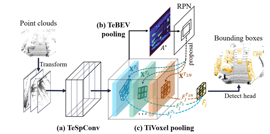
Transformation-Equivariant 3D Object Detection for Autonomous Driving
AAAI 2023
@misc{https://doi.org/10.48550/arxiv.2211.11962, doi = {10.48550/ARXIV.2211.11962}, url = {https://arxiv.org/abs/2211.11962}, author = {Wu, Hai and Wen, Chenglu and Li, Wei and Li, Xin and Yang, Ruigang and Wang, Cheng}, keywords = {Computer Vision and Pattern Recognition (cs.CV), FOS: Computer and information sciences, FOS: Computer and information sciences}, title = {Transformation-Equivariant 3D Object Detection for Autonomous Driving}, publisher = {arXiv}, year = {2022}, copyright = {arXiv.org perpetual, non-exclusive license} }
2022
Hai Wu, Jinhao Deng, Chenglu Wen*, Xin Li, Cheng Wang, Jonathan Li
CasA: A Cascade Attention Network for 3D Object Detection from LiDAR point clouds
IEEE Transactions on Geoscience and Remote Sensing, DOI: 10.1109/TGRS.2022.3203163
@ARTICLE{9870747, author={Wu, Hai and Deng, Jinhao and Wen, Chenglu and Li, Xin and Wang, Cheng and Li, Jonathan}, journal={IEEE Transactions on Geoscience and Remote Sensing}, title={CasA: A Cascade Attention Network for 3-D Object Detection From LiDAR Point Clouds}, year={2022}, volume={60}, number={}, pages={1-11}, doi={10.1109/TGRS.2022.3203163}}
Wenkai Han, Hai Wu, Chenglu Wen*, et al
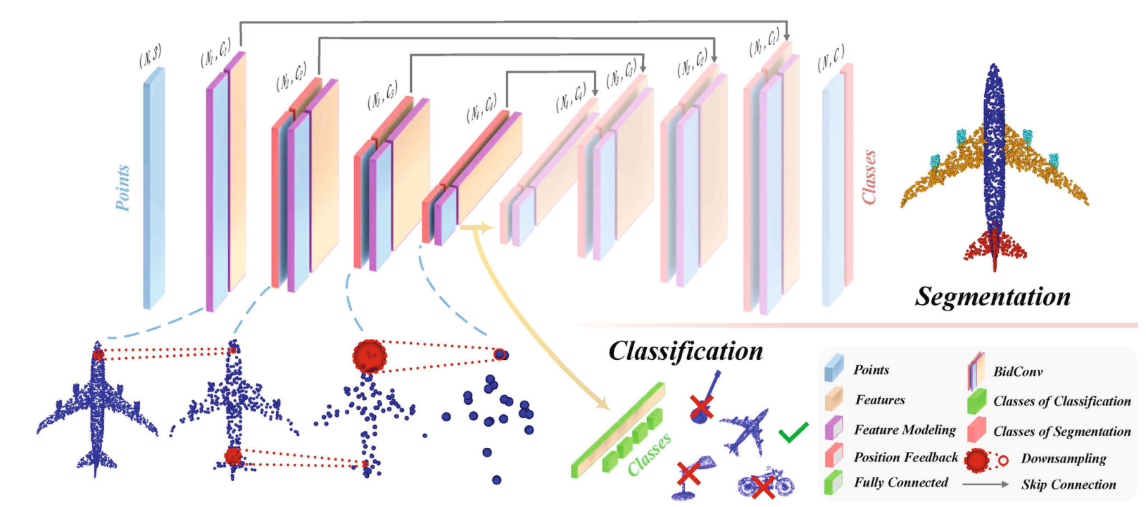
BLNet: Bidirectional Learning Network for Point Clouds
Computational Visual Media,DOI: 10.1007/s41095-021-0260-6
@article{Han2022, author = {Wenkai Han and Hai Wu and Chenglu Wen and Cheng Wang and Xin Li}, title = {BLNet: Bidirectional learning network for point clouds}, year = {2022}, journal = {Computational Visual Media}, volume = {8}, number = {4}, pages = {585-596}, keywords = {point clouds, irregularity, shape features, bidirectional learning}, url = {https://www.sciopen.com/article/10.1007/s41095-021-0260-6}, doi = {10.1007/s41095-021-0260-6}, }
Shangshu Yu, Cheng Wang, Chenglu Wen*, Ming Cheng, Minghao Liu, Zhihong Zhang, Xin Li
LiDAR-based Localization using Universal Encoding and Memory-aware Regression
Pattern Recognition, DOI:10.1016/j.patcog.2022.108685
@article{YU2022108685, title = {LiDAR-based Localization using Universal Encoding and Memory-aware Regression}, journal = {Pattern Recognition}, pages = {108685}, year = {2022}, issn = {0031-3203}, doi = {https://doi.org/10.1016/j.patcog.2022.108685}, url = {https://www.sciencedirect.com/science/article/pii/S0031320322001662}, author = {Shangshu Yu and Cheng Wang and Chenglu Wen and Ming Cheng and Minghao Liu and Zhihong Zhang and Xin Li}, keywords = {LiDAR localization, Absolute pose regression, Universal encoding, Privacy preserving, Memory-aware regression}, abstract = {Visual localization is critical to many robotics and computer vision applications. Absolute pose regression performs localization by encoding scene features followed by pose regression, which has achieved impressive results in localization. It recovers 6-DoF poses from captured scene data alone. However, current methods suffer from being retrained with specific source data whenever the scene changes, resulting in expensive computational costs, data privacy disclosure, and unreliable localization caused by the inability to memorize all data. In this paper, we propose a novel LiDAR-based absolute pose regression network with universal encoding to avoid redundant retraining and the loss of data privacy. Specifically, we propose using universal feature encoding for different scenes. Only the regressor needs to be retrained to achieve higher efficiency, and the training is performed using the encoded features without source data, which preserves data privacy. Then, we propose a memory regressor for memory-aware regression, where the hidden unit numbers in the regressor determine the memorization capacity. It can be used to derive and improve the upper bound of the capacity to enable more reliable localization. Then, it is possible to modify the regressor structure to adapt different memorization capacity requirements for different scene sizes. Extensive experiments on outdoor and indoor datasets validated the above analyses and demonstrated the effectiveness of the proposed method.} }
Jialian Li, Jingyi Zhang, Zhiyong Wang, Siqi Shen, Chenglu Wen, Yuexi Ma, Lan Xu, JingYi Yu, Cheng Wang*
LiDARCap: Long-range Marker-less 3D Human Motion Capture with LiDAR Point Clouds
CVPR
@misc{https://doi.org/10.48550/arxiv.2203.14698, doi = {10.48550/ARXIV.2203.14698}, url = {https://arxiv.org/abs/2203.14698}, author = {Li, Jialian and Zhang, Jingyi and Wang, Zhiyong and Shen, Siqi and Wen, Chenglu and Ma, Yuexin and Xu, Lan and Yu, Jingyi and Wang, Cheng}, keywords = {Computer Vision and Pattern Recognition (cs.CV), FOS: Computer and information sciences, FOS: Computer and information sciences}, title = {LiDARCap: Long-range Marker-less 3D Human Motion Capture with LiDAR Point Clouds}, publisher = {arXiv}, year = {2022}, copyright = {Creative Commons Attribution 4.0 International} }
Yudi Dai, Yitai Lin, Chenglu Wen*, Siqi Shen, Lan Xu, Jingyi Yu, Yuexi Ma, Cheng Wang
HSC4D: Human-centered 4D Scene Capture in Large-scale Indoor-outdoor Space Using Wearable IMUs and LiDAR
CVPR, DOI:10.48550/arXiv.2203.09215, 2022
@misc{https://doi.org/10.48550/arxiv.2203.09215, doi = {10.48550/ARXIV.2203.09215}, url = {https://arxiv.org/abs/2203.09215}, author = {Dai, Yudi and Lin, Yitai and Wen, Chenglu and Shen, Siqi and Xu, Lan and Yu, Jingyi and Ma, Yuexin and Wang, Cheng}, keywords = {Computer Vision and Pattern Recognition (cs.CV), Artificial Intelligence (cs.AI), FOS: Computer and information sciences, FOS: Computer and information sciences}, title = {HSC4D: Human-centered 4D Scene Capture in Large-scale Indoor-outdoor Space Using Wearable IMUs and LiDAR}, publisher = {arXiv}, year = {2022}, copyright = {Creative Commons Attribution 4.0 International} }
Xuelun Shen, Cheng Wang, Xin Li, Yifan Peng, Zijian He, Chenglu Wen, Ming Cheng
Learning scale awareness in keypoint extraction and description
Pattern Recognition
title = {Learning scale awareness in keypoint extraction and description}, journal = {Pattern Recognition}, volume = {121}, pages = {108221}, year = {2022}, issn = {0031-3203}, doi = {https://doi.org/10.1016/j.patcog.2021.108221}, url = {https://www.sciencedirect.com/science/article/pii/S0031320321004027}, author = {Xuelun Shen and Cheng Wang and Xin Li and Yifan Peng and Zijian He and Chenglu Wen and Ming Cheng}, keywords = {Keypoint detection, Keypoint description, Image matching, Structure from motion, 3D reconstruction}, abstract = {To recover relative camera motion accurately and robustly, establishing a set of point-to-point correspondences in the pixel space is an essential yet challenging task in computer vision. Even though multi-scale design philosophy has been used with significant success in computer vision tasks, such as object detection and semantic segmentation, learning-based image matching has not been fully exploited. In this work, we explore a scale awareness learning approach in finding pixel-level correspondences based on the intuition that keypoints need to be extracted and described on an appropriate scale. With that insight, we propose a novel scale-aware network and then develop a new fusion scheme that derives high-consistency response maps and high-precision descriptions. We also revise the Second Order Similarity Regularization (SOSR) to make it more effective for the end-to-end image matching network, which leads to significant improvement in local feature descriptions. Experimental results run on multiple datasets demonstrate that our approach performs better than state-of-the-art methods under multiple criteria.} }
2021
Hai Wu, Wenkai Han, Chenglu Wen*, Xin Li, Cheng Wang
3D Multi-Object Tracking in Point Clouds Based on Prediction Confidence-Guided Data Association
IEEE Transactions on Intelligent Transportation Systems
@ARTICLE{9352500, author={Wu, Hai and Han, Wenkai and Wen, Chenglu and Li, Xin and Wang, Cheng}, journal={IEEE Transactions on Intelligent Transportation Systems}, title={3D Multi-Object Tracking in Point Clouds Based on Prediction Confidence-Guided Data Association}, year={2021}, volume={}, number={}, pages={1-10}, doi={10.1109/TITS.2021.3055616}}
Hai Wu, Qing Li, Chenglu Wen*, Xin Li, Xiaoliang Fan, Cheng Wang
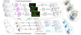
Tracklet Proposal Network for Multi-Object Tracking on Point Clouds
IJCAI
@inproceedings{ijcai2021p161, title = {Tracklet Proposal Network for Multi-Object Tracking on Point Clouds}, author = {Wu, Hai and Li, Qing and Wen, Chenglu and Li, Xin and Fan, Xiaoliang and Wang, Cheng}, booktitle = {Proceedings of the Thirtieth International Joint Conference on Artificial Intelligence, {IJCAI-21}}, publisher = {International Joint Conferences on Artificial Intelligence Organization}, editor = {Zhi-Hua Zhou}, pages = {1165--1171}, year = {2021}, month = {8}, note = {Main Track}, doi = {10.24963/ijcai.2021/161}, url = {https://doi.org/10.24963/ijcai.2021/161}, }
Lili Lin, Wenwen Zhang, Ming Cheng, Chenglu Wen, Cheng Wang
Planar Primitive Group-Based Point Cloud Registration for Autonomous Vehicle Localization in Underground Parking Lots
IEEE Geoscience and Remote Sensing Letters
@ARTICLE{9343732, author={Lin, Lili and Zhang, Wenwen and Cheng, Ming and Wen, Chenglu and Wang, Cheng}, journal={IEEE Geoscience and Remote Sensing Letters}, title={Planar Primitive Group-Based Point Cloud Registration for Autonomous Vehicle Localization in Underground Parking Lots}, year={2021}, volume={}, number={}, pages={1-5}, doi={10.1109/LGRS.2021.3053252}}
Qing Li, Cheng Wang, Xin Li, Chenglu Wen
FeatFlow: Learning geometric features for 3D motion estimation
Pattern Recognition
@article{LI2021107574, title = {FeatFlow: Learning geometric features for 3D motion estimation}, journal = {Pattern Recognition}, volume = {111}, pages = {107574}, year = {2021}, issn = {0031-3203}, doi = {https://doi.org/10.1016/j.patcog.2020.107574}, url = {https://www.sciencedirect.com/science/article/pii/S0031320320303770}, author = {Qing Li and Cheng Wang and Xin Li and Chenglu Wen}, keywords = {Feature learning, Motion estimation, Point clouds, Scene flow, Scan-matching, Ego-motion}, abstract = {3D motion estimation is an important prerequisite for the autonomous operation of vehicles and robots in dynamic environments. This work presents FeatFlow, a novel neural network architecture to estimate 3D motions from unstructured point clouds. Specifically, we learn deep geometric features to estimate the dense scene flow and the ego-motion of the platform. We build a scene flow estimation pipeline by an encoder-decoder architecture which comprises three novel modules: feature extractor, motion embedder, and flow decoder. By using a point-score layer to assign scores to the extracted features in a learning procedure, the feature extractor effectively extracts keypoints and features that are most significant for estimating the relative transformation between two consecutive point clouds. The whole model adaptively learns the required robust descriptors to represent a variety of point motions at the object or scene level. We evaluated our approach on synthetic data from FlyingThings3D, and real-world LiDAR scans from KITTI and Oxford RobotCar. Our network successfully generalizes to datasets with different patterns, outperforming various baselines and achieving state-of-the-art performance.} }
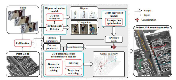
Yudi Dai, Chenglu Wen*, Hai Wu, Yulan Guo, Longbiao Chen, Cheng Wang
Indoor 3D Human Trajectory Reconstruction Using Surveillance Camera Videos and Point Clouds
IEEE Transactions on Circuits and Systems for Video Technology, 32(4): 2482-2495, 2022
@ARTICLE{9433501, author={Dai, Yudi and Wen, Chenglu and Wu, Hai and Guo, Yulan and Chen, Longbiao and Wang, Cheng}, journal={IEEE Transactions on Circuits and Systems for Video Technology}, title={Indoor 3D Human Trajectory Reconstruction Using Surveillance Camera Videos and Point Clouds}, year={2021}, volume={}, number={}, pages={1-1}, doi={10.1109/TCSVT.2021.3081591}}
Chenglu Wen, Jinbin Tan, Fashuai Li, Chongrong Wu, Yitai Lin, Zhiyong Wang, Cheng Wang
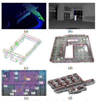
Cooperative indoor 3D mapping and modeling using LiDAR data
Information Sciences, 574:192- 209, 2021
@article{WEN2021192, title = {Cooperative indoor 3D mapping and modeling using LiDAR data}, journal = {Information Sciences}, volume = {574}, pages = {192-209}, year = {2021}, issn = {0020-0255}, doi = {https://doi.org/10.1016/j.ins.2021.06.006}, url = {https://www.sciencedirect.com/science/article/pii/S0020025521005934}, author = {Chenglu Wen and Jinbin Tan and Fashuai Li and Chongrong Wu and Yitai Lin and Zhiyong Wang and Cheng Wang}, keywords = {Frame-level semantic labeling, Line model, Point-cloud-based mapping}, abstract = {Point clouds and models with semantic information facilitate various indoor automation, ranging from indoor robotics to emergency responses. Studies are currently being conducted on semantic labeling and modeling based on offline mapped point clouds, in which, the performance is strongly limited by the mapping process. To address this issue, we propose a framework to cooperatively perform the three tasks of semantic labeling, mapping, and 3D modeling of point clouds. First, our framework uses a deep-learning-assisted method to perform frame-level point cloud semantic labeling. Subsequently, point cloud frames with semantic labels are used to extract the structural planes of buildings, followed by the generation of line structures from the planes. Then, these frames are used to estimate the initial poses of a 3D sensor for data collection. In the subsequent pose optimization process, the initial poses are optimized under the constraints of the structural planes. Finally, the optimized poses are used to integrate semantic frames and line structures to generate a point cloud map and 3D line model of buildings. The experimental results show that the proposed method achieves better results than the state-of-the-art methods that separately perform one of the two tasks.} }
2020
Cheng Wang, Yudi Dai, Naser Elsheimy, Chenglu Wen, Guenther Retscher, Zhizhong Kang, Andrea Lingua
ISPRS Benchmark on multisensory indoor indoor mapping and positioning
ISPRS Annals of Photogrammetry, Remote Sensing & Spatial Information Sciences
@article{wang2020isprs, title={ISPRS BENCHMARK ON MULTISENSORY INDOOR MAPPING AND POSITIONING.}, author={Wang, Cheng and Dai, Yudi and Elsheimy, Naser and Wen, Chenglu and Retscher, Guenther and Kang, Zhizhong and Lingua, Andrea}, journal={ISPRS Annals of Photogrammetry, Remote Sensing \& Spatial Information Sciences}, volume={5}, number={5}, year={2020} }
Wenkai Han,Chenglu Wen*,Cheng Wang,Xin Li,Qing Li
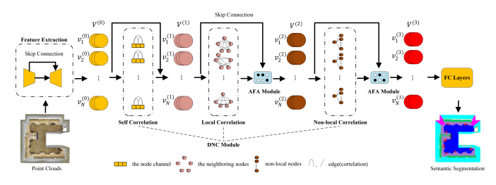
Point2Node:correlation Learning of Dynamic-Node for Point Cloud Feature Modeling
AAAI oral
@article{2019Point2Node, title={Point2Node: Correlation Learning of Dynamic-Node for Point Cloud Feature Modeling}, author={ Han, W. and Wen, C. and Wang, C. and Li, X. and Li, Q. }, year={2019}, }
Wei Li, Cheng Wang, Chenglu Wen, Zheng Zhang, Congren Lin, Jonathan Li
Pairwise registration of TLS point clouds by deep multi-scale local features
Neurocomputing
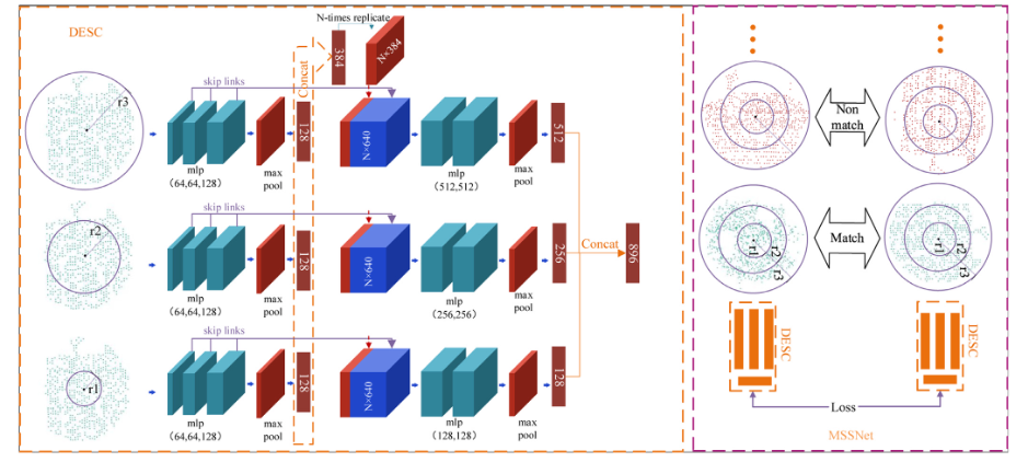
@article{LI2020232, title = {Pairwise registration of TLS point clouds by deep multi-scale local features}, journal = {Neurocomputing}, volume = {386}, pages = {232-243}, year = {2020}, issn = {0925-2312}, doi = {https://doi.org/10.1016/j.neucom.2019.12.074}, url = {https://www.sciencedirect.com/science/article/pii/S0925231219317837}, author = {Wei Li and Cheng Wang and Chenglu Wen and Zheng Zhang and Congren Lin and Jonathan Li}, keywords = {MSSNet, Point cloud registration, Terrestrial laser scanning (TLS), Data augmentation, Geometric constraints}, abstract = {Because of the mechanism of TLS system, noise, outliers, various occlusions, varying cloud densities, etc. inevitably exist in the collection of TLS point clouds. To achieve automatic TLS point cloud registration, many methods, based on the hand-crafted features of keypoints, have been proposed. Despite significant progress, the current methods still face great challenges in accomplishing TLS point cloud registration. In this paper, we propose a multi-scale neural network to learn local shape descriptors for establishing correspondences between pairwise TLS point clouds. To train our model, data augmentation, developed on pairwise semi-synthetic 3D local patches, is to extend our network to be robust to rotation transformation. Then, based on varying local neighborhoods, multi-scale subnetworks are constructed and fused to learn robust local features. Experimental results demonstrate that our proposed method successfully registers two TLS point clouds and outperforms state-of-the-art methods. Besides, our learned descriptors are invariant to translation and tolerant to changes in rotation.} }
Wei Li, Cheng Wang, Congren Lin, Guobao Xiao, Chenglu Wen, Jonathan Li
Inlier extraction for point cloud registration via supervoxel guidance and game theory optimization
ISPRS Journal of Photogrammetry and Remote Sensing, DOI:10.1016/j.isprsjprs.2020.01.021, 2020
@article{LI2020284, title = {Inlier extraction for point cloud registration via supervoxel guidance and game theory optimization}, journal = {ISPRS Journal of Photogrammetry and Remote Sensing}, volume = {163}, pages = {284-299}, year = {2020}, issn = {0924-2716}, doi = {https://doi.org/10.1016/j.isprsjprs.2020.01.021}, url = {https://www.sciencedirect.com/science/article/pii/S0924271620300277}, author = {Wei Li and Cheng Wang and Congren Lin and Guobao Xiao and Chenglu Wen and Jonathan Li}, keywords = {Supervoxel segmentation, Non-cooperative game, Keypoint correspondences, Point cloud registration}, abstract = {As a key step in Six-Degree-of-Freedom (6DoF) point cloud registration, 3D keypoint technique aims to extract matches or inliers from random correspondences between the two keypoint sets. The major challenge in 3D keypoint techniques is the high ratio of mismatched or outliers in random correspondences in real-world point cloud registration. In this paper, we present a novel inlier extraction method, which is based on Supervoxel Guidance and Game Theory optimization (SGGT), to extract reliable inliers and apply for point cloud registration. Specifically, to reduce the scale of keypoint correspondences, we first construct powerful groups of keypoint correspondences by introducing supervoxels, which involves 3D spatial homogeneity. Second, to select promising combined groups, we present a novel ‘fit-and-remove’ strategy by incorporating 3D local transformation constraints. Third, to extract purer inliers for point cloud registration, we propose a grouping non-cooperative game algorithm, which considers the relationship between the combined groups. The proposed SGGT, by eliminating the mismatched combined groups globally, avoids the false combined groups that lead to the failed estimation of rigid transformations. Experimental results show that when processing on large keypoint sets, the proposed SGGT is over 100 times more efficient compared to the stat-of-the-art, while keeping the similar accuracy.} }
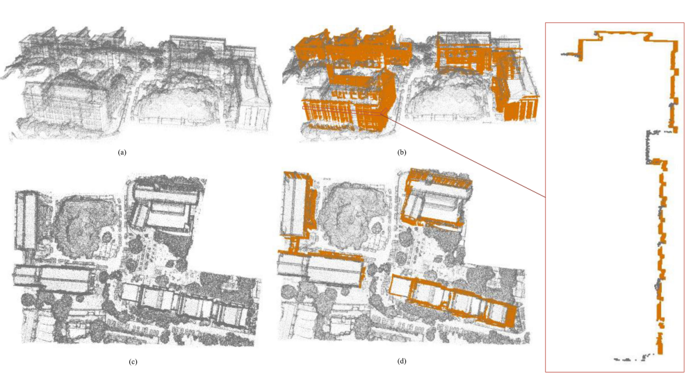
Cheng Wang, Chenglu Wen, Yudi Dai, Shangshu Yu, Minghao Liu
Urban 3D modeling with mobile laser scanning: a review
Virtual Reality & Intelligent Hardware, DOI:10.1016/j.vrih.2020.05.003, 2020
@article{WANG2020175, title = {Urban 3D modeling with mobile laser scanning: a review}, journal = {Virtual Reality & Intelligent Hardware}, volume = {2}, number = {3}, pages = {175-212}, year = {2020}, note = {3D Visual Processing and Reconstruction Special Issue}, issn = {2096-5796}, doi = {https://doi.org/10.1016/j.vrih.2020.05.003}, url = {https://www.sciencedirect.com/science/article/pii/S2096579620300395}, author = {Cheng Wang and Chenglu Wen and Yudi Dai and Shangshu Yu and Minghao Liu}, keywords = {3D Modeling, MMS, LIDAR, Urban}, abstract = {Mobile laser scanning (MLS) systems mainly comprise laser scanners and mobile mapping platforms. Typical MLS systems are able to acquire three-dimensional point clouds with 1-10 centimeter point spacing at a normal driving or walking speed in the street or indoor environments. The MLS' advantages of efficiency and stability make it a quite practical tool for three-dimensional urban modeling. This paper reviews the latest advances in 3D modeling of the LiDAR-based mobile mapping system (MMS) point cloud, including LiDAR Simultaneous Localization and Mapping (SLAM), point cloud registration, feature extraction, object extraction, semantic segmentation, and deep learning processing. Then typical urban modeling applications based on MMS are also discussed.} }
Yi-Ting Cheng, Ankit Patel, Chenglu Wen, Darcy Bullock, Ayman Habib
Intensity Thresholding and Deep Learning Based Lane Marking Extraction and Lane Width Estimation from Mobile Light Detection and Ranging (LiDAR) Point Clouds
Remote Sensing, DOI:10.3390/rs12091379, 2020
@Article{rs12091379, AUTHOR = {Cheng, Yi-Ting and Patel, Ankit and Wen, Chenglu and Bullock, Darcy and Habib, Ayman}, TITLE = {Intensity Thresholding and Deep Learning Based Lane Marking Extraction and Lane Width Estimation from Mobile Light Detection and Ranging (LiDAR) Point Clouds}, JOURNAL = {Remote Sensing}, VOLUME = {12}, YEAR = {2020}, NUMBER = {9}, ARTICLE-NUMBER = {1379}, URL = {https://www.mdpi.com/2072-4292/12/9/1379}, ISSN = {2072-4292}, ABSTRACT = {Lane markings are one of the essential elements of road information, which is useful for a wide range of transportation applications. Several studies have been conducted to extract lane markings through intensity thresholding of Light Detection and Ranging (LiDAR) point clouds acquired by mobile mapping systems (MMS). This paper proposes an intensity thresholding strategy using unsupervised intensity normalization and a deep learning strategy using automatically labeled training data for lane marking extraction. For comparative evaluation, original intensity thresholding and deep learning using manually established labels strategies are also implemented. A pavement surface-based assessment of lane marking extraction by the four strategies is conducted in asphalt and concrete pavement areas covered by MMS equipped with multiple LiDAR scanners. Additionally, the extracted lane markings are used for lane width estimation and reporting lane marking gaps along various highways. The normalized intensity thresholding leads to a better lane marking extraction with an F1-score of 78.9% in comparison to the original intensity thresholding with an F1-score of 72.3%. On the other hand, the deep learning model trained with automatically generated labels achieves a higher F1-score of 85.9% than the one trained on manually established labels with an F1-score of 75.1%. In concrete pavement area, the normalized intensity thresholding and both deep learning strategies obtain better lane marking extraction (i.e., lane markings along longer segments of the highway have been extracted) than the original intensity thresholding approach. For the lane width results, more estimates are observed, especially in areas with poor edge lane marking, using the two deep learning models when compared with the intensity thresholding strategies due to the higher recall rates for the former. The outcome of the proposed strategies is used to develop a framework for reporting lane marking gap regions, which can be subsequently visualized in RGB imagery to identify their cause.}, DOI = {10.3390/rs12091379} }
2019
Zongliang Zhang, Chenglu Wen, Yiping Chen, Wei Li, Changbin You, Chao Wang, J Li
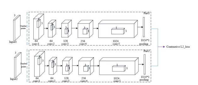
Indoor scene registration based on siamese network and pointnet
ISPRS Annals of the Photogrammetry, Remote Sensing and Spatial Information Sciences
@article{zhang2019indoor, title={Indoor scene registration based on siamese network and pointnet}, author={Zhang, Zongliang and Wen, Chenglu and Chen, Yiping and Li, Wei and You, Changbin and Wang, Chao and Li, J}, journal={ISPRS Annals of the Photogrammetry, Remote Sensing and Spatial Information Sciences}, volume={4}, pages={307--312}, year={2019}, publisher={Copernicus GmbH} }
Cheng Wang, Yudi Dai, Naser El-Sheimy, Chenglu Wen, Guenther Retscher, Zhizhong Kang, Andrea Lingua
PROGRESS ON ISPRS BENCHMARK ON MULTISENSORY INDOOR MAPPING AND POSITIONING.
International Archives of the Photogrammetry, Remote Sensing & Spatial Information Sciences
@article{wang2019progress, title={PROGRESS ON ISPRS BENCHMARK ON MULTISENSORY INDOOR MAPPING AND POSITIONING.}, author={Wang, Cheng and Dai, Yudi and El-Sheimy, Naser and Wen, Chenglu and Retscher, Guenther and Kang, Zhizhong and Lingua, Andrea}, journal={International Archives of the Photogrammetry, Remote Sensing \& Spatial Information Sciences}, year={2019} }
Qing Li, Cheng Wang, Shaoyang Chen, Xin Li, Chenglu Wen, Ming Cheng, Jonathan Li
DEEP LIDAR ODOMETRY.
International Archives of the Photogrammetry, Remote Sensing & Spatial Information Sciences
@article{li2019deep, title={DEEP LIDAR ODOMETRY.}, author={Li, Qing and Wang, Cheng and Chen, Shaoyang and Li, Xin and Wen, Chenglu and Cheng, Ming and Li, Jonathan}, journal={International Archives of the Photogrammetry, Remote Sensing \& Spatial Information Sciences}, year={2019} }
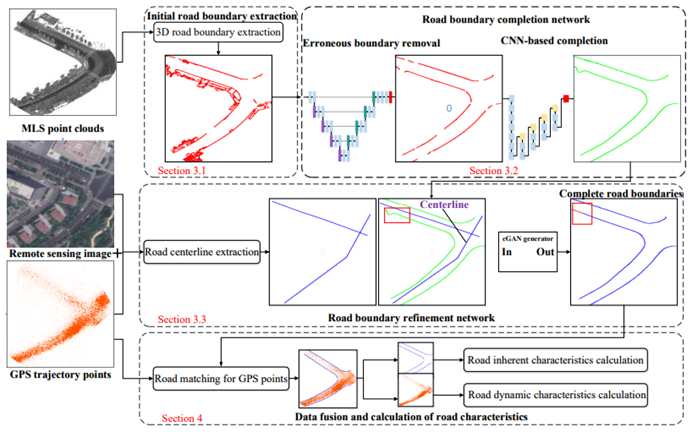
Chenglu Wen, Changbin You, Hai Wu, Cheng Wang, Xiaoliang Fan, Jonathan Li
Recovery of urban 3D road boundary via multi-source data
ISPRS Journal of Photogrammetry and Remote Sensing
none
Shanxin Zhang, Cheng Wang, Lili Lin, Chenglu Wen, Chenhui Yang, Zhemin Zhang, Jonathan Li
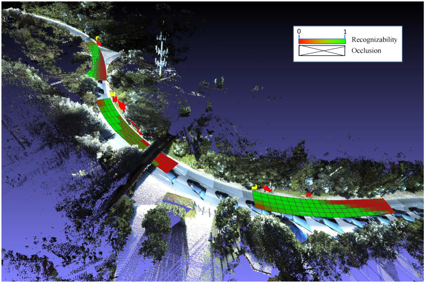
Automated Visual Recognizability Evaluation of Traffic Sign Based on 3D LiDAR Point Clouds
Remote Sensing, DOI:10.3390/rs11121453, 2019
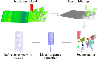
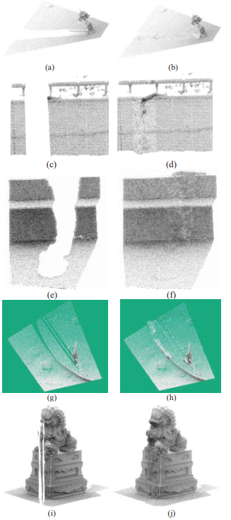
@Article{rs11121453, AUTHOR = {Zhang, Shanxin and Wang, Cheng and Lin, Lili and Wen, Chenglu and Yang, Chenhui and Zhang, Zhemin and Li, Jonathan}, TITLE = {Automated Visual Recognizability Evaluation of Traffic Sign Based on 3D LiDAR Point Clouds}, JOURNAL = {Remote Sensing}, VOLUME = {11}, YEAR = {2019}, NUMBER = {12}, ARTICLE-NUMBER = {1453}, URL = {https://www.mdpi.com/2072-4292/11/12/1453}, ISSN = {2072-4292}, ABSTRACT = {Maintaining the high visual recognizability of traffic signs for traffic safety is a key matter for road network management. Mobile Laser Scanning (MLS) systems provide efficient way of 3D measurement over large-scale traffic environment. This paper presents a quantitative visual recognizability evaluation method for traffic signs in large-scale traffic environment based on traffic recognition theory and MLS 3D point clouds. We first propose the Visibility Evaluation Model (VEM) to quantitatively describe the visibility of traffic sign from any given viewpoint, then we proposed the concept of visual recognizability field and Traffic Sign Visual Recognizability Evaluation Model (TSVREM) to measure the visual recognizability of a traffic sign. Finally, we present an automatic TSVREM calculation algorithm for MLS 3D point clouds. Experimental results on real MLS 3D point clouds show that the proposed method is feasible and efficient.}, DOI = {10.3390/rs11121453} }
Chenglu Wen*, Yudi Dai, Yan Xia, Yuhan Lian, Jinbin Tan, Cheng Wang, Jonathan Li
Toward Efficient 3-D Colored Mapping in GPS-/GNSS-Denied Environments
IEEE Geoscience and Remote Sensing Letters, DOI:10.1109/LGRS.2019.2916844, 2019
@ARTICLE{8736839, author={Wen, Chenglu and Dai, Yudi and Xia, Yan and Lian, Yuhan and Tan, Jinbin and Wang, Cheng and Li, Jonathan}, journal={IEEE Geoscience and Remote Sensing Letters}, title={Toward Efficient 3-D Colored Mapping in GPS-/GNSS-Denied Environments}, year={2020}, volume={17}, number={1}, pages={147-151}, doi={10.1109/LGRS.2019.2916844}}
Zheng Gong, Jonathan Li, Zhipeng Luo, Chenglu Wen, Cheng Wang, John Zelek
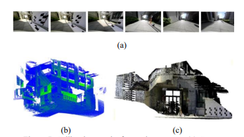
Mapping and semantic modeling of underground parking lots using a backpack LiDAR system
IEEE Transactions on Intelligent Transportation Systems, DOI:10.1109/TITS.2019.2955734, 2019
@ARTICLE{8924918, author={Gong, Zheng and Li, Jonathan and Luo, Zhipeng and Wen, Chenglu and Wang, Cheng and Zelek, John}, journal={IEEE Transactions on Intelligent Transportation Systems}, title={Mapping and Semantic Modeling of Underground Parking Lots Using a Backpack LiDAR System}, year={2021}, volume={22}, number={2}, pages={734-746}, doi={10.1109/TITS.2019.2955734}}
Chuanpan Zheng, Xiaoliang Fan, Chenglu Wen, Longbiao Chen, Cheng Wang, Jonathan Li
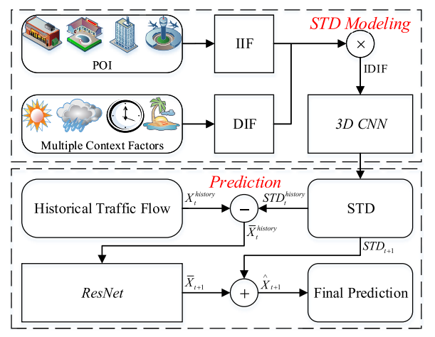
DeepSTD: Mining Spatio-Temporal Disturbances of Multiple Context Factors for Citywide Traffic Flow Prediction
IEEE Transactions on Intelligent Transportation Systems, DOI:10.1109/TITS.2019.2932785, 2019
@ARTICLE{8793226, author={Zheng, Chuanpan and Fan, Xiaoliang and Wen, Chenglu and Chen, Longbiao and Wang, Cheng and Li, Jonathan}, journal={IEEE Transactions on Intelligent Transportation Systems}, title={DeepSTD: Mining Spatio-Temporal Disturbances of Multiple Context Factors for Citywide Traffic Flow Prediction}, year={2020}, volume={21}, number={9}, pages={3744-3755}, doi={10.1109/TITS.2019.2932785}}
Xuelun Shen, Cheng Wang, Xin Li, Zenglei Yu, Jonathan Li, Chenglu Wen, Ming Cheng, Zijian He
Rf-net: An end-to-end image matching network based on receptive field
CVPR, DOI:10.1109/CVPR.2019.00832, 2019
@InProceedings{Shen_2019_CVPR, author = {Shen, Xuelun and Wang, Cheng and Li, Xin and Yu, Zenglei and Li, Jonathan and Wen, Chenglu and Cheng, Ming and He, Zijian}, title = {RF-Net: An End-To-End Image Matching Network Based on Receptive Field}, booktitle = {Proceedings of the IEEE/CVF Conference on Computer Vision and Pattern Recognition (CVPR)}, month = {June}, year = {2019} }
Chenglu Wen, Xiaotian Sun, Jonathan Li, Cheng Wang, Yan Guo, Ayman Habib
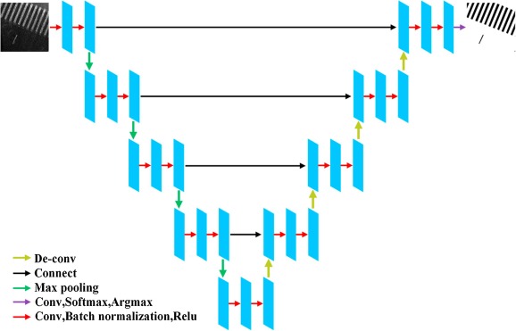
A deep learning framework for road marking extraction, classification and completion from mobile laser scanning point clouds
ISPRS journal of photogrammetry and remote sensing, DOI:10.1016/j.isprsjprs.2018.10.007, 2019
@article{WEN2019178, title = {A deep learning framework for road marking extraction, classification and completion from mobile laser scanning point clouds}, journal = {ISPRS Journal of Photogrammetry and Remote Sensing}, volume = {147}, pages = {178-192}, year = {2019}, issn = {0924-2716}, doi = {https://doi.org/10.1016/j.isprsjprs.2018.10.007}, url = {https://www.sciencedirect.com/science/article/pii/S0924271618302855}, author = {Chenglu Wen and Xiaotian Sun and Jonathan Li and Cheng Wang and Yan Guo and Ayman Habib}, keywords = {Point cloud, Road marking, Extraction, Classification, Completion, Deep learning}, abstract = {Road markings play a critical role in road traffic safety and are one of the most important elements for guiding autonomous vehicles (AVs). High-Definition (HD) maps with accurate road marking information are very useful for many applications ranging from road maintenance, improving navigation, and prediction of upcoming road situations within AVs. This paper presents a deep learning-based framework for road marking extraction, classification and completion from three-dimensional (3D) mobile laser scanning (MLS) point clouds. Compared with existing road marking extraction methods, which are mostly based on intensity thresholds, our method is less sensitive to data quality. We added the step of road marking completion to further optimize the results. At the extraction stage, a modified U-net model was used to segment road marking pixels to overcome the intensity variation, low contrast and other issues. At the classification stage, a hierarchical classification method by integrating multi-scale clustering with Convolutional Neural Networks (CNN) was developed to classify different types of road markings with considerable differences. At the completion stage, a method based on a Generative Adversarial Network (GAN) was developed to complete small-size road markings first, then followed by completing broken lane lines and adding missing markings using a context-based method. In addition, we built a point cloud road marking dataset to train the deep network model and evaluate our method. The dataset contains urban road and highway MLS data and underground parking lot data acquired by our own assembled backpacked laser scanning system. Our experimental results obtained using the point clouds of different scenes demonstrated that our method is very promising for road marking extraction, classification and completion.} }
Qing Li, Shaoyang Chen, Cheng Wang, Xin Li, Chenglu Wen, Ming Cheng, Jonathan Li
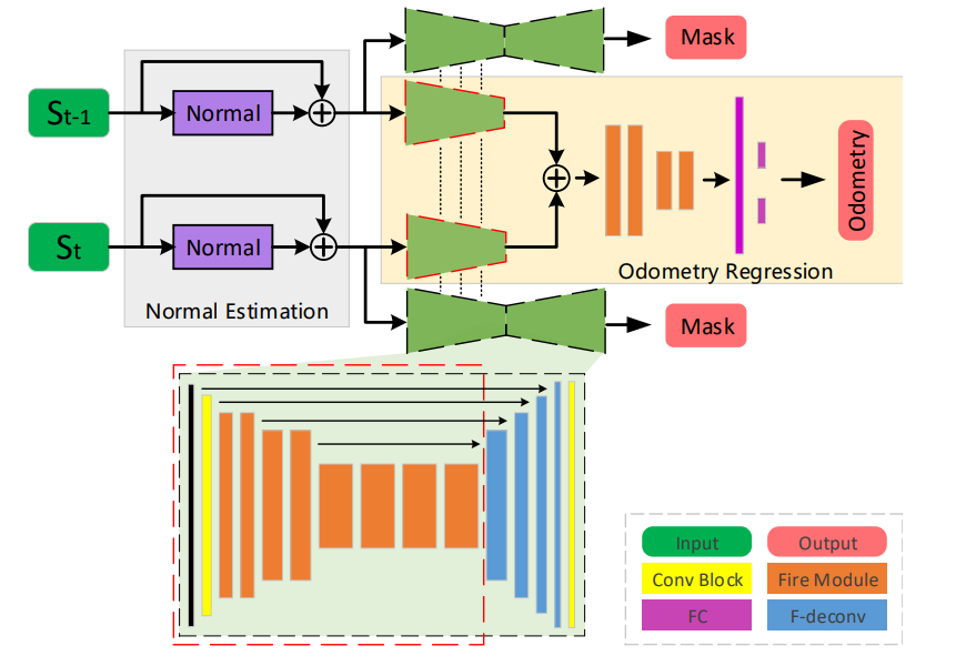
Lo-net: Deep real-time lidar odometry
CVPR,DOI:10.1109/CVPR.2019.00867, 2019
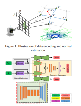
@InProceedings{Li_2019_CVPR, author = {Li, Qing and Chen, Shaoyang and Wang, Cheng and Li, Xin and Wen, Chenglu and Cheng, Ming and Li, Jonathan}, title = {LO-Net: Deep Real-Time Lidar Odometry}, booktitle = {Proceedings of the IEEE/CVF Conference on Computer Vision and Pattern Recognition (CVPR)}, month = {June}, year = {2019} }
2018
Cheng Wang, Shiwei Hou, Chenglu Wen, Zheng Gong, Qing Li, Xiaotian Sun, Jonathan Li
Semantic line framework-based indoor building modeling using backpacked laser scanning point cloud
ISPRS journal of photogrammetry and remote sensing
@article{wang2018semantic, title={Semantic line framework-based indoor building modeling using backpacked laser scanning point cloud}, author={Wang, Cheng and Hou, Shiwei and Wen, Chenglu and Gong, Zheng and Li, Qing and Sun, Xiaotian and Li, Jonathan}, journal={ISPRS journal of photogrammetry and remote sensing}, volume={143}, pages={150--166}, year={2018}, publisher={Elsevier} }
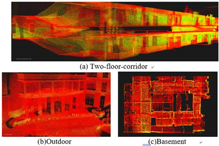
Chenglu Wen, Yan Xia, Yuhan Lian, Yudi Dai, Jinbin Tan, Cheng Wang, Jonathan Li
MOBILE LASER SCANNING SYSTEMS FOR GPS/GNSS-DENIED ENVIRONMENT MAPPING
International Archives of the Photogrammetry, Remote Sensing and Spatial Information Sciences
@article{wen2018mobile, title={MOBILE LASER SCANNING SYSTEMS FOR GPS/GNSS-DENIED ENVIRONMENT MAPPING}, author={Wen, Chenglu and Xia, Yan and Lian, Yuhan and Dai, Yudi and Tan, Jinbin and Wang, Cheng and Li, Jonathan}, journal={International Archives of the Photogrammetry, Remote Sensing and Spatial Information Sciences}, volume={42}, pages={1}, year={2018} }
Changbin You, Chenglu Wen*, Cheng Wang, Jonathan Li and Ayman Habib,
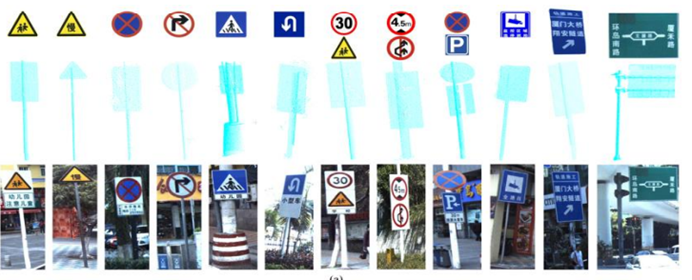
Joint 2D-3D Traffic Sign Landmark Dataset for Geo-localization using Mobile Laser Scanning Data
IEEE Transactions on Intelligent Transportation Systems
@ARTICLE{8478211, author={You, Changbin and Wen, Chenglu and Wang, Cheng and Li, Jonathan and Habib, Ayman}, journal={IEEE Transactions on Intelligent Transportation Systems}, title={Joint 2-D–3-D Traffic Sign Landmark Data Set for Geo-Localization Using Mobile Laser Scanning Data}, year={2019}, volume={20}, number={7}, pages={2550-2565}, doi={10.1109/TITS.2018.2868168}}
Chenglu Wen*, Xiaotian Sun, Shiwei Hou, Jinbin Tan, Yudi Dai, Cheng Wang, Jonathan Li
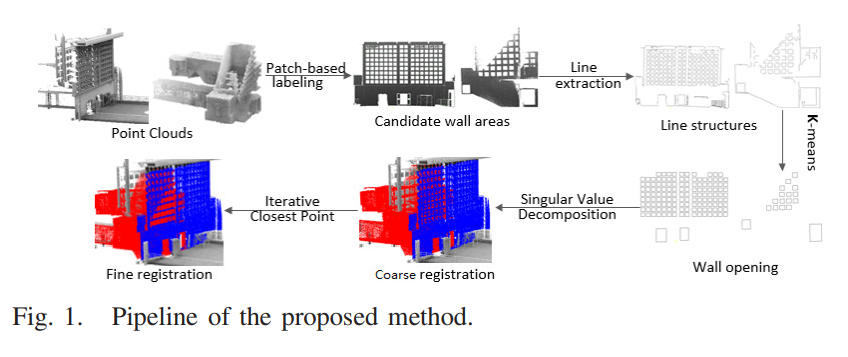
Line structure-based indoor and outdoor integration using backpacked and TLS point cloud data
IEEE Geoscience and Remote Sensing Letters
@ARTICLE{8424509, author={Wen, Chenglu and Sun, Xiaotian and Hou, Shiwei and Tan, Jinbin and Dai, Yudi and Wang, Cheng and Li, Jonathan}, journal={IEEE Geoscience and Remote Sensing Letters}, title={Line Structure-Based Indoor and Outdoor Integration Using Backpacked and TLS Point Cloud Data}, year={2018}, volume={15}, number={11}, pages={1790-1794}, doi={10.1109/LGRS.2018.2856514}}
Wei Li, Cheng Wang, Dawei Zai, Pengdi Huang, Weiquan Liu, Chenglu Wen, Jonathan Li
A Volumetric Fusing Method for TLS and SFM Point Clouds
IEEE Journal of Selected Topics in Applied Earth Observations and Remote Sensing
@ARTICLE{8428532, author={Li, Wei and Wang, Cheng and Zai, Dawei and Huang, Pengdi and Liu, Weiquan and Wen, Chenglu and Li, Jonathan}, journal={IEEE Journal of Selected Topics in Applied Earth Observations and Remote Sensing}, title={A Volumetric Fusing Method for TLS and SFM Point Clouds}, year={2018}, volume={11}, number={9}, pages={3349-3357}, doi={10.1109/JSTARS.2018.2856900}}
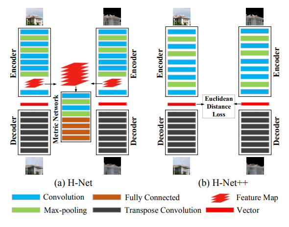
Weiquan Liu, Xuelun Shen, Cheng Wang, Zhihong Zhang, Chenglu Wen, Jonathan Li
H-Net: Neural Network for Cross-domain Image Patch Matching.
IJCAI
@inproceedings{DBLP:conf/ijcai/LiuSWZWL18, author={Weiquan Liu and Xuelun Shen and Cheng Wang and Zhihong Zhang and Chenglu Wen and Jonathan Li}, title={H-Net: Neural Network for Cross-domain Image Patch Matching}, year={2018}, cdate={1514764800000}, pages={856-863}, url={https://doi.org/10.24963/ijcai.2018/119}, booktitle={IJCAI}, crossref={conf/ijcai/2018} }
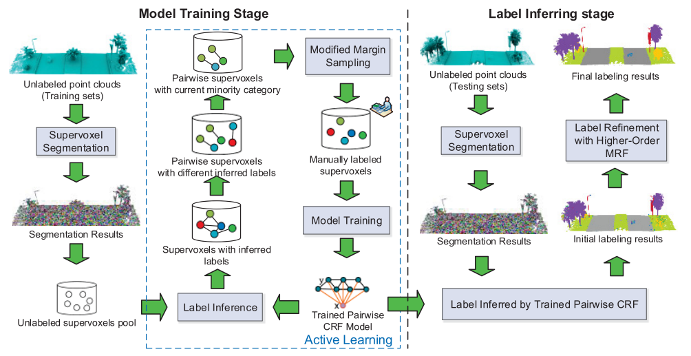
Huan Luo, Cheng Wang, Chenglu Wen, Ziyi Chen, Dawei Zai, Yongtao Yu, Jonathan Li
Semantic labeling of mobile LiDAR point clouds via active learning and higher order MRF
IEEE Transactions on Geoscience and Remote Sensing, DOI:10.1109/TGRS.2018.2802935, 2018
@ARTICLE{8353504, author={Luo, Huan and Wang, Cheng and Wen, Chenglu and Chen, Ziyi and Zai, Dawei and Yu, Yongtao and Li, Jonathan}, journal={IEEE Transactions on Geoscience and Remote Sensing}, title={Semantic Labeling of Mobile LiDAR Point Clouds via Active Learning and Higher Order MRF}, year={2018}, volume={56}, number={7}, pages={3631-3644}, doi={10.1109/TGRS.2018.2802935}}
2017
Zheng Gong, Chenglu Wen*, Cheng Wang, Jonathan Li
A Target-free Automatic Self-Calibration Approach for Multi-Beam Laser Scanners
IEEE Transactions on Instrumentation and Measurement
@article{gong2017target, title={A target-free automatic self-calibration approach for multibeam laser scanners}, author={Gong, Zheng and Wen, Chenglu and Wang, Cheng and Li, Jonathan}, journal={IEEE Transactions on Instrumentation and Measurement}, volume={67}, number={1}, pages={238--240}, year={2017}, publisher={IEEE} }
Fan Wu, Chenglu Wen*, Yan Guo, Jinjin Wang, Yongtao Yu, Cheng Wang, Jonathan Li,
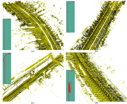
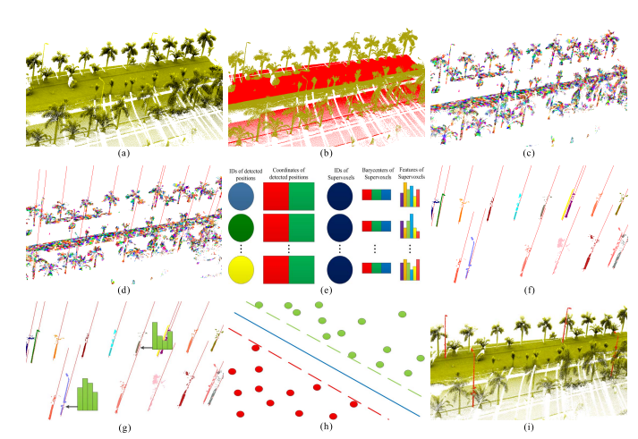
Rapid Localization and Extraction of Street Light Poles in Mobile LiDAR Point Clouds: A Supervoxel-based Approach
IEEE Transactions on Intelligent Transportation Systems
None
2016
Fangfang Huang, Chenglu Wen, Cheng Wang, Jonathan Li
Feature selection for quality assessment of indoor mobile mapping point clouds
2nd ISPRS International Conference on Computer Vision in Remote Sensing (CVRS 2015)
@inproceedings{huang2016feature, title={Feature selection for quality assessment of indoor mobile mapping point clouds}, author={Huang, Fangfang and Wen, Chenglu and Wang, Cheng and Li, Jonathan}, booktitle={2nd ISPRS International Conference on Computer Vision in Remote Sensing (CVRS 2015)}, volume={9901}, pages={99010B}, year={2016}, organization={International Society for Optics and Photonics} }
Li Wei, Cheng Wang, Chenglu Wen
Change detection based on integration of multi-scale mixed-resolution information
2nd ISPRS International Conference on Computer Vision in Remote Sensing (CVRS 2015)
@inproceedings{wei2016change, title={Change detection based on integration of multi-scale mixed-resolution information}, author={Wei, Li and Wang, Cheng and Wen, Chenglu}, booktitle={2nd ISPRS International Conference on Computer Vision in Remote Sensing (CVRS 2015)}, volume={9901}, pages={99010H}, year={2016}, organization={International Society for Optics and Photonics} }
Rosen Wu, Yiping Chen, Chenglu Wen, Cheng Wang, Jonathan Li
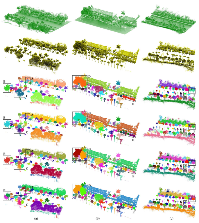
Delineation of individual tree crowns for mobile laser scanning data
2nd ISPRS International Conference on Computer Vision in Remote Sensing (CVRS 2015)
@inproceedings{wu2016delineation, title={Delineation of individual tree crowns for mobile laser scanning data}, author={Wu, Rosen and Chen, Yiping and Wen, Chenglu and Wang, Cheng and Li, Jonathan}, booktitle={2nd ISPRS International Conference on Computer Vision in Remote Sensing (CVRS 2015)}, volume={9901}, pages={990109}, year={2016}, organization={International Society for Optics and Photonics} }
Xichao Guo, Cheng Wang, Chenglu Wen, Ming Cheng
Automatic target extraction in complicated background for camera calibration
2nd ISPRS International Conference on Computer Vision in Remote Sensing (CVRS 2015)
@inproceedings{guo2016automatic, title={Automatic target extraction in complicated background for camera calibration}, author={Guo, Xichao and Wang, Cheng and Wen, Chenglu and Cheng, Ming}, booktitle={2nd ISPRS International Conference on Computer Vision in Remote Sensing (CVRS 2015)}, volume={9901}, pages={99010R}, year={2016}, organization={International Society for Optics and Photonics} }
Qing Xiang, Jonathan Li, Chenglu Wen, Pengdi Huang
Extraction of power lines from mobile laser scanning data
2nd ISPRS International Conference on Computer Vision in Remote Sensing (CVRS 2015)
@inproceedings{xiang2016extraction, title={Extraction of power lines from mobile laser scanning data}, author={Xiang, Qing and Li, Jonathan and Wen, Chenglu and Huang, Pengdi}, booktitle={2nd ISPRS International Conference on Computer Vision in Remote Sensing (CVRS 2015)}, volume={9901}, pages={990105}, year={2016}, organization={International Society for Optics and Photonics} }
Yongtao Yu, Jonathan Li, Haiyan Guan, Cheng Wang, Chenglu Wen
Bag of contextual-visual words for road scene object detection from mobile laser scanning data
IEEE Transactions on Intelligent Transportation Systems
@article{yu2016bag, title={Bag of contextual-visual words for road scene object detection from mobile laser scanning data}, author={Yu, Yongtao and Li, Jonathan and Guan, Haiyan and Wang, Cheng and Wen, Chenglu}, journal={IEEE Transactions on Intelligent Transportation Systems}, volume={17}, number={12}, pages={3391--3406}, year={2016}, publisher={IEEE} }
Chenglu Wen*, Siyu Pan, Cheng Wang, Jonathan Li
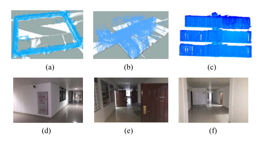
An indoor backpack system for 2-D and 3-D mapping of building interiors
IEEE Geoscience and Remote Sensing Letters
@article{wen2016indoor, title={An indoor backpack system for 2-D and 3-D mapping of building interiors}, author={Wen, Chenglu and Pan, Siyu and Wang, Cheng and Li, Jonathan}, journal={IEEE Geoscience and Remote Sensing Letters}, volume={13}, number={7}, pages={992--996}, year={2016}, publisher={IEEE} }
Fan Wu, Chenglu Wen, Yulan Guo, Jingjing Wang, Yongtao Yu, Cheng Wang, Jonathan Li
Rapid localization and extraction of street light poles in mobile LiDAR point clouds: A supervoxel-based approach
IEEE Transactions on Intelligent Transportation Systems
@ARTICLE{7497465, author={Wu, Fan and Wen, Chenglu and Guo, Yulan and Wang, Jingjing and Yu, Yongtao and Wang, Cheng and Li, Jonathan}, journal={IEEE Transactions on Intelligent Transportation Systems}, title={Rapid Localization and Extraction of Street Light Poles in Mobile LiDAR Point Clouds: A Supervoxel-Based Approach}, year={2017}, volume={18}, number={2}, pages={292-305}, doi={10.1109/TITS.2016.2565698}}
Fangfang Huang, Chenglu Wen, Huan Luo, Ming Cheng, Cheng Wang, Jonathan Li
Local quality assessment of point clouds for indoor mobile mapping
Neurocomputing
@article{huang2016local, title={Local quality assessment of point clouds for indoor mobile mapping}, author={Huang, Fangfang and Wen, Chenglu and Luo, Huan and Cheng, Ming and Wang, Cheng and Li, Jonathan}, journal={Neurocomputing}, volume={196}, pages={59--69}, year={2016}, publisher={Elsevier} }
Chenglu Wen, Jonathan Li, Huan Luo, Yongtao Yu, Zhipeng Cai, Hanyun Wang, Cheng Wang
Spatial-related traffic sign inspection for inventory purposes using mobile laser scanning data
IEEE Transactions on Intelligent Transportation Systems
None
Huan Luo, Cheng Wang, Chenglu Wen*, Zhipeng Cai, Ziyi Chen, et al.
Patch-Based Semantic Labeling of Road Scene Using Colorized Mobile LiDAR Point Clouds
IEEE Transactions on Intelligent Transportation Systems
None
Fangfang Huang, Chenglu Wen*, Huan Luo, Ming Cheng, Cheng Wang, Jonathan Li
Local quality assessment of point clouds for indoor mobile mapping
Neurocomputing, DOI:10.1016/j.neucom.2016.02.033
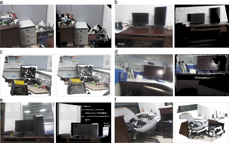
@article{HUANG201659, title = {Local quality assessment of point clouds for indoor mobile mapping}, journal = {Neurocomputing}, volume = {196}, pages = {59-69}, year = {2016}, issn = {0925-2312}, doi = {https://doi.org/10.1016/j.neucom.2016.02.033}, url = {https://www.sciencedirect.com/science/article/pii/S0925231216002678}, author = {Fangfang Huang and Chenglu Wen and Huan Luo and Ming Cheng and Cheng Wang and Jonathan Li}, keywords = {Local quality assessment, Indoor mobile mapping, Point clouds, Degradation, Machine learning}, abstract = {The quality of point clouds obtained by RGB-D camera-based indoor mobile mapping can be limited by local degradation because of complex scenarios such as sensor characteristics, partial occlusions, cluttered backgrounds, and complex illumination conditions. This paper presents a machine learning framework to assess the local quality of indoor mobile mapping point cloud data. In our proposed framework, a point cloud dataset with multiple kinds of quality problems is first created by manual annotation and degradation simulation. Then, feature extraction methods based on 3D patches are treated as operating units to conduct quality assessment in local regions. Also, a feature selection algorithm is deployed to obtain the essential components of feature sets that are used to effectively represent local degradation. Finally, a semi-supervised method is introduced to classify quality types of point clouds. Comparative experiments demonstrate that the proposed framework obtained promising quality assessment results with limited labeled data and a large amount of unlabeled data.} }
Yongtao Yu, Jonathan Li, Haiyan Guan, Cheng Wang, Chenglu Wen
Bag of Contextual-Visual Words for Road Scene Object Detection From Mobile Laser Scanning Data
IEEE Transactions on Intelligent Transportation Systems, DOI:10.1109/TITS.2016.2550798, 2016
@ARTICLE{7463045, author={Yu, Yongtao and Li, Jonathan and Guan, Haiyan and Wang, Cheng and Wen, Chenglu}, journal={IEEE Transactions on Intelligent Transportation Systems}, title={Bag of Contextual-Visual Words for Road Scene Object Detection From Mobile Laser Scanning Data}, year={2016}, volume={17}, number={12}, pages={3391-3406}, doi={10.1109/TITS.2016.2550798}}
Chenglu Wen*, Siyu Pan, Cheng Wang, Jonathan Li
An indoor backpack system for 2-D and 3-D mapping of building interiors
IEEE Geoscience and Remote Sensing Letters, DOI:10.1109/LGRS.2016.2558486, 2016
@ARTICLE{7468519, author={Wen, Chenglu and Pan, Siyu and Wang, Cheng and Li, Jonathan}, journal={IEEE Geoscience and Remote Sensing Letters}, title={An Indoor Backpack System for 2-D and 3-D Mapping of Building Interiors}, year={2016}, volume={13}, number={7}, pages={992-996}, doi={10.1109/LGRS.2016.2558486}}
Ziyi Chen, Cheng Wang, Huan Luo, Hanyun Wang, Yiping Chen, Chenglu Wen, Yongtao Yu, Liujuan Cao, Jonathan Li
Vehicle detection in high-resolution aerial images based on fast sparse representation classification and multiorder feature
IEEE transactions on intelligent transportation systems, DOI:10.1109/TGRS.2015.2451002, 2016
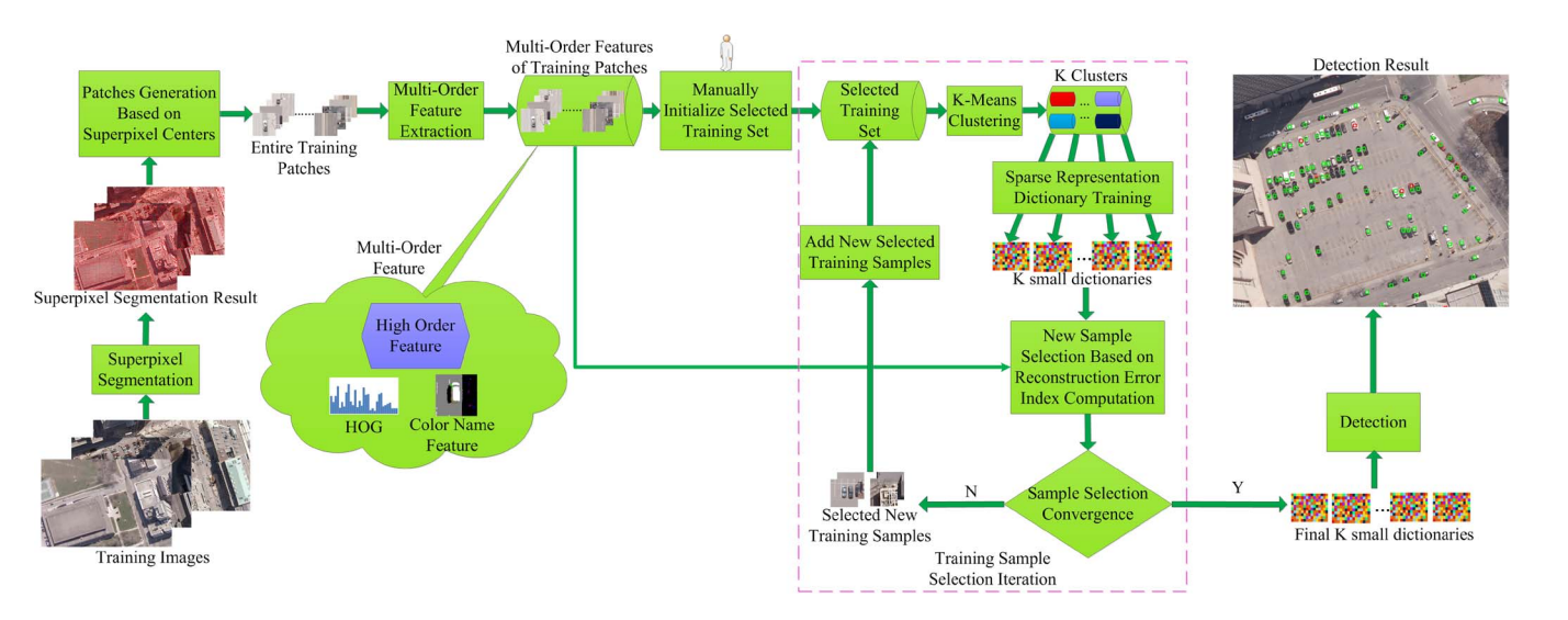
@ARTICLE{7410075, author={Chen, Ziyi and Wang, Cheng and Luo, Huan and Wang, Hanyun and Chen, Yiping and Wen, Chenglu and Yu, Yongtao and Cao, Liujuan and Li, Jonathan}, journal={IEEE Transactions on Intelligent Transportation Systems}, title={Vehicle Detection in High-Resolution Aerial Images Based on Fast Sparse Representation Classification and Multiorder Feature}, year={2016}, volume={17}, number={8}, pages={2296-2309}, doi={10.1109/TITS.2016.2517826}}
2015
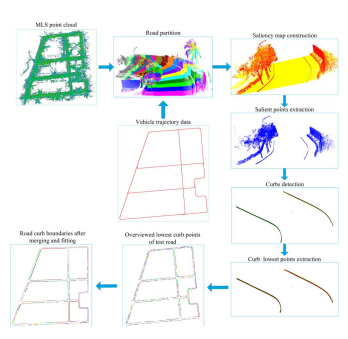
Hanyun Wang, Huan Luo, Chenglu Wen*, Jun Cheng, Peng Li, Yiping Chen, Cheng Wang, Jonathan Li
Road boundaries detection based on local normal saliency from mobile laser scanning data
IEEE Geoscience and remote sensing letters
@ARTICLE{7153515, author={Wang, Hanyun and Luo, Huan and Wen, Chenglu and Cheng, Jun and Li, Peng and Chen, Yiping and Wang, Cheng and Li, Jonathan}, journal={IEEE Geoscience and Remote Sensing Letters}, title={Road Boundaries Detection Based on Local Normal Saliency From Mobile Laser Scanning Data}, year={2015}, volume={12}, number={10}, pages={2085-2089}, doi={10.1109/LGRS.2015.2449074}}
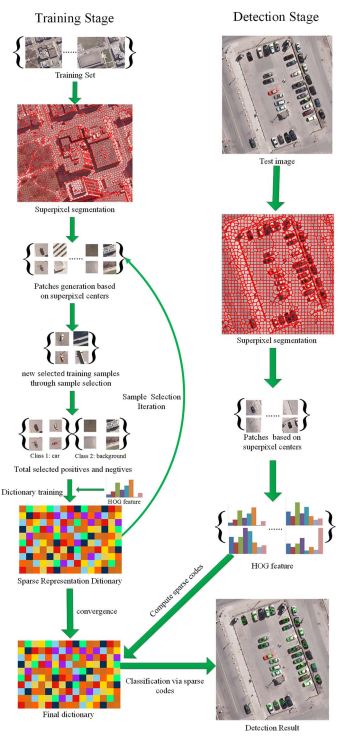
Ziyi Chen, Cheng Wang, Chenglu Wen, Xiuhua Teng, Yiping Chen, Haiyan Guan, Huan Luo, Liujuan Cao, Jonathan Li
Vehicle detection in high-resolution aerial images via sparse representation and superpixels
IEEE Transactions on Geoscience and Remote Sensing
@article{chen2015vehicle, title={Vehicle detection in high-resolution aerial images via sparse representation and superpixels}, author={Chen, Ziyi and Wang, Cheng and Wen, Chenglu and Teng, Xiuhua and Chen, Yiping and Guan, Haiyan and Luo, Huan and Cao, Liujuan and Li, Jonathan}, journal={IEEE Transactions on Geoscience and Remote Sensing}, volume={54}, number={1}, pages={103--116}, year={2015}, publisher={IEEE} }
Chenglu Wen, Daoxi Wu, Huosheng Hu, Wei Pan
Pose estimation-dependent identification method for field moth images using deep learning architecture
biosystems engineering
@article{wen2015pose, title={Pose estimation-dependent identification method for field moth images using deep learning architecture}, author={Wen, Chenglu and Wu, Daoxi and Hu, Huosheng and Pan, Wei}, journal={biosystems engineering}, volume={136}, pages={117--128}, year={2015}, publisher={Elsevier} }
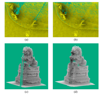
Zhipeng Cai, Cheng Wang, Chenglu Wen, Jonathan Li
Occluded Boundary Detection for Small-Footprint Groundborne LIDAR Point Cloud Guided by Last Echo
IEEE Geoscience and Remote Sensing Letters
@article{cai2015occluded, title={Occluded Boundary Detection for Small-Footprint Groundborne LIDAR Point Cloud Guided by Last Echo}, author={Cai, Zhipeng and Wang, Cheng and Wen, Chenglu and Li, Jonathan}, journal={IEEE Geoscience and Remote Sensing Letters}, volume={12}, number={11}, pages={2272--2276}, year={2015}, publisher={IEEE} }
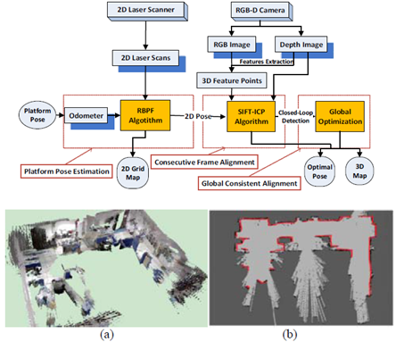
Chenglu Wen*, Ling Qin, Cheng Wang, Jonathan Li,
Three-dimensional Indoor Mapping with Fusion of Two-dimensional Laser Scanner and RGB-D Camera Data
IEEE Geoscience and Remote Sensing Letters
None
Zhipeng Cai, Cheng Wang, Chenglu Wen, Jonathan Li
3D-PatchMatch: An optimization algorithm for point cloud completion
2015 2nd IEEE International Conference on Spatial Data Mining and Geographical Knowledge Services (ICSDM)
@INPROCEEDINGS{7298044, author={Cai, Zhipeng and Wang, Cheng and Wen, Chenglu and Li, Jonathan}, booktitle={2015 2nd IEEE International Conference on Spatial Data Mining and Geographical Knowledge Services (ICSDM)}, title={3D-PatchMatch: An optimization algorithm for point cloud completion}, year={2015}, volume={}, number={}, pages={157-161}, doi={10.1109/ICSDM.2015.7298044}}